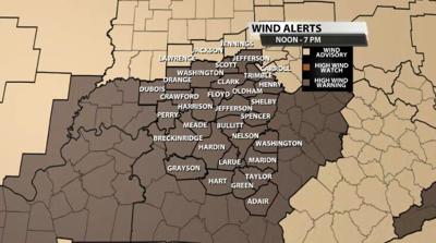
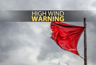
The National Weather Service in Louisville has issued a High Wind Warning for our area as wind gusts today will max out around 60 mph outside of thunderstorms. That is strong enough to do damage; power outages will be possible.

If a thunderstorm develops and has wind gusts 55-60 mph, those will be handled with a Severe Thunderstorm Warning based on each storm. This High Wind Warning is meant to alert you to the fact that wind will be strong all day even without thunderstorms. Below is the text issued with the Warning:
...WIND ADVISORY NOW IN EFFECT UNTIL NOON EST /11 AM CST/ TODAY...
...HIGH WIND WARNING IN EFFECT FROM NOON EST /11 AM CST/ TODAY TO
7 PM EST /6 PM CST/ THIS EVENING...
...WIND ADVISORY IN EFFECT FROM 7 PM EST /6 PM CST/ THIS EVENING
TO 7 AM EST /6 AM CST/ SATURDAY...
* WHAT...Wind gusts this morning will gradually increase in
intensity, peaking this afternoon and early evening. Widespread
gust over 50 mph expected, with sporadic gusts of 58 mph or more
this afternoon and early evening. Gusts for much of the
overnight hours will range from 40 to 50 mph.
* WHERE...Portions of southern Indiana and central Kentucky.
* WHEN...A wind advisory will remain in effect until noon EST /11
AM CST/ today. A High Wind Warning will then go into effect at
noon EST /11 AM CST/ today and last until 7 PM EST /6 PM CST/
this evening. Afterwards, a wind advisory will then be in effect
from 7 PM EST /6 PM CST/ this evening to 7 AM EST /6 AM CST/
Saturday.
* IMPACTS...Damaging winds will blow down trees and power lines.
Power outages are expected. Travel will be difficult, especially
for high profile vehicles.
PRECAUTIONARY/PREPAREDNESS ACTIONS...
People should avoid being outside in forested areas and around
trees and branches. If possible, remain indoors during the most
intense part of the windstorm. Use caution if you must drive.


