


We got a little snow today, but it didn't amount to much... and it didn't stick around for long. Besides some flurries over the next 24 hours, this was our last chance at snow before Christmas.

Midday snow in Underwood, IN - picture credit to Anita Kaye Seibel Davis
Historically, Kentuckiana has around a 10% chance of having a white Christmas. That means about once in every ten years we wake up to 1" of snow (or more) on the ground Christmas morning.

Chance for a white Christmas map from the NWS in Louisville
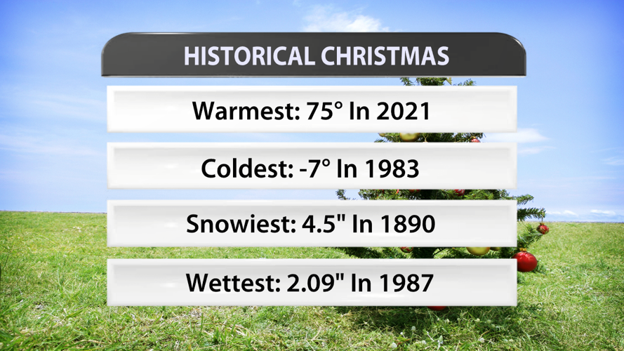
Christmas around here can range from sunshine and 60s to very snowy and even well-below 0. You'll find some historical facts about weather extremes on Christmas day below.

Historical Christmas weather data from the NWS in Louisville
This year will be a few degrees warmer than normal with plenty of cloud cover and even a chance for some rain. That rain chance is low right now, but changes are very possible as was approach Christmas itself.

AvdanceTrak graphic from WDRB's WSI weather graphics system


