
Spring brings snow, heat, flooding rains, severe weather, and frigid cold temperatures. Sometimes, we get it a few different types of weather within the same week! With that said, it's obvious that Easter is no stranger to extremes. Let's talk about what Louisville has experienced on Easter's in the past and what we'll get this year.
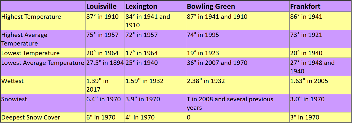
Louisville warmest Easter took place in 1910 at 87°, but the coldest Easter took place in 1964 at 20°.
The wettest Easter on record for Louisville took place just 10 years ago with 1.39" of rain falling that day.
Louisville even saw more than 6" of snow fall throughout the day on Easter in 1970. At its deepest, there was exactly half a foot of snow on the ground that day.

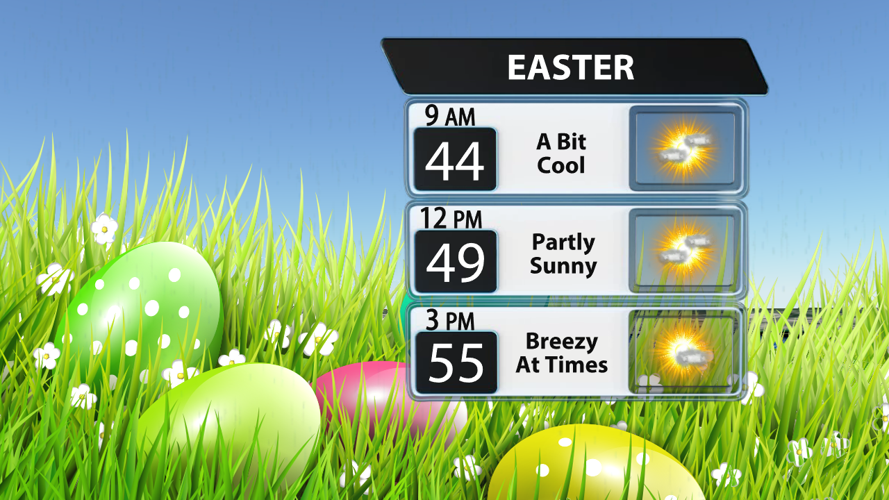
We're not expecting any extremes this year! Instead, we'll just be a bit cool, breezy, and have increasing sunshine throughout the day. Highs will struggle to get to climb through the 50s because of the northerly breeze around 20 mph at times, but sunshine will help bring temperatures up a bit.

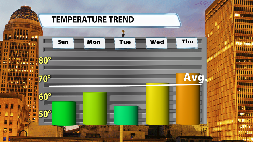
The cold front crossing the region this evening will drop our highs to the 50s Sunday, but a dry cold front brings reinforcing cold air to keep us cool on Monday and Tuesday. This front will bring a couple of solid chances for some frost Tuesday morning and Wednesday morning. After Wednesday's cool start, temperatures will quickly climb through the 60s and into the 70s before the end of the work week.


