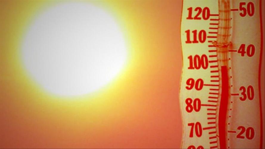
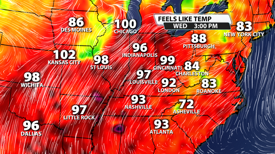


Now that the rain has come to an end, temperatures are climbing. Highs today have topped out around 90 degrees in most spots, and we'll probably do the same tomorrow. But it's more than just heat that gives us the summertime feeling. It's the humidity that really takes the temperatures up a notch. "Feels like" temperatures have been in the middle 90s to low 100s along the Mississippi River and across the Midwest.

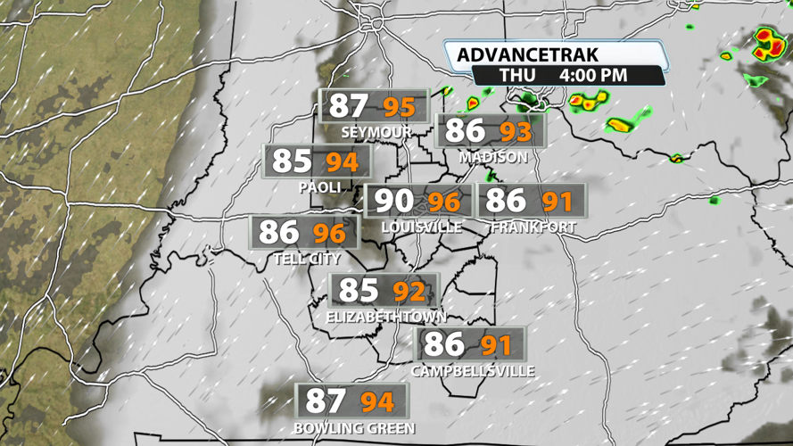
Thursday has more of the same with temperatures around 90 degrees and "feels-like" temps around 100 degrees in the hottest spots. We'll add in a few chances for showers and storms as well.

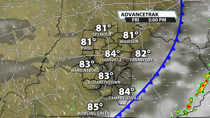
Friday brings us a nice change! Showers and storms along a cold front should fall apart as they approach the region, but we'll keep some rain chances in the forecast. With the cold frontal passage happening in the morning to early afternoon hours, high temperatures could still top out in the middle 80s. But you'll definitely notice a drop in dew points for the late afternoon and evening hours.

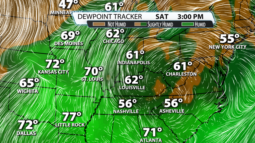
Saturday will be absolutely picture perfect behind the cold front. Dew points will be in the upper 50s to low 60s. Temperatures will top out in the middle 80s with mostly to partly sunny skies.


