
The 2026 Atlantic hurricane season runs from June 1 through November 30. Throughout the season, the U.S. Geological Survey aids coastal and inland communities by giving people the resources they need to make informed decisions before, during, and after hurricanes. This critical information helps save lives and protect property.

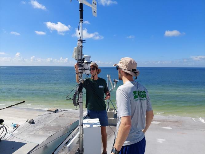
USGS Scientists, Justin Birchler and Johnathan Woodruff, maintain the CoastCam at Madeira Beach, FL before Hurricane Helene. This camera is used to monitor waves and coastal water levels as storms impact the beach. It's made possible through partnerships between the USGS and local business owners/community leaders. For more information, check out the USGS CoastCams page and the Total Water Level & Coastal Change Forecast Viewer.
When a hurricane is approaching, people want answers. How bad will it be? Will my neighborhood flood? Will the beach road still be there tomorrow?
Behind the scenes, scientists at the U.S. Geological Survey work to answer these and many other questions well before a storm arrives. Their work doesn’t always make headlines, but it plays a critical role in helping emergency managers, local officials, and the public make informed decisions when time is short and the stakes are high.
This work isn’t just about collecting data. It’s about providing the science that people use to save lives, protect property, and help communities recover faster.

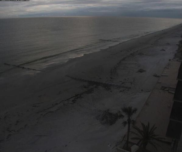
CoastCam on Madeira Beach in Florida on October 8, 2024 before Hurricane Milton made landfall on October 9, 2024.
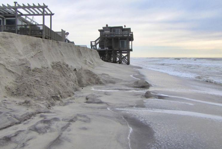
One of the most immediate threats from hurricanes is coastal erosion. Storm surge and waves can wipe out dunes, flood roads, and reshape shorelines in a matter of hours.
To help communities prepare, USGS scientists provide real-time storm forecasts of where beaches are likely to erode, where sand may be pushed inland, and where storm surge could inundate roads and homes. These forecasts are available through the Total Water Level and Coastal Change Forecast Viewer, which emergency managers use to prioritize evacuations and protect infrastructure.
For example, during Hurricane Ian in 2022, these forecasts accurately predicted widespread dune loss along Florida’s Gulf Coast. That information helped local officials prepare for road closures and post-storm damage assessments.

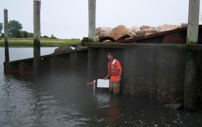
In anticipation of coastal tidal storm surge from high winds associated with Tropical Storm Irene, USGS deployed a series of storm surge sensors along the New England coastline to monitor the severity of storm surge. This is an example of a storm surge sensor deployment by Hydrologic Technician Tim Sargent in Guilford, CT at the Guilford Town Dock on August 27, 2011, the day before Irene hit New England. This location is part of the New England SWaTH network and the location ID is SSS-CT-FFD-017WL.
Credit: Jason Pollender, U.S. Geological Survey
Hurricanes don’t just affect the coast. Inland flooding is just as dangerous, especially when rivers rise quickly or when stormwater systems are overwhelmed.
The USGS operates a nationwide network of streamgages and rapid-deployment gauges that provide real-time data on river levels and flood conditions. These sensors are often installed in advance of a storm, sometimes within hours of landfall, to capture critical data that supports the emergency response.
During Hurricane Harvey in 2017, these flood sensors helped emergency managers in Texas track rising waters and direct rescue operations. That same system remains in place today, ready to respond when the next storm arrives.

Flood maps from Our Coast, Our Future showing Stinson Beach today (slide 1); with a 50-centimeter sea-level rise (slide 2); and when an annual storm strikes in addition to 50-centimeter sea-level rise (slide 3). Green patches are low-lying areas prone to flooding. Explore more: Our Coast Our Future (OCOF, https://ourcoastourfuture.org) is a collaborative, user-driven project focused on providing coastal California resource managers and land use planners locally relevant, online maps and tools to help understand, visualize, and anticipate vulnerabilities to sea level rise and storms.
Once the skies clear, the work isn’t over. Communities need to know what has changed, including which roads are washed out, which neighborhoods remain underwater, and where recovery efforts should begin.
The USGS provides high-resolution aerial imagery and lidar land surface scans that map storm impacts. These maps help the Federal Emergency Management Agency, state agencies, and local governments assess damage, plan repairs, and aid those impacted when applying for federal assistance.
After Hurricane Laura in 2020, USGS imagery helped identify areas of severe coastal erosion and infrastructure loss across Louisiana’s barrier islands. This data supported both emergency response and long-term restoration planning.

At Fire Island, estuarine, wetland, coastal, and oceanic processes interact, affecting natural and human communities. The CMHRP has been conducting scientific investigations at Fire Island in order to protect coastal infrastructure.
The science behind these tools is complex. But the reason it exists is simple: to provide vital data that decision makers need as they work to help save lives and protect property.
Whether it’s a family deciding when to evacuate, a mayor planning emergency routes, or a utility crew restoring power, USGS data helps people make informed decisions when it matters most.
This work doesn’t happen in isolation. It’s part of a coordinated effort with the National Oceanic and Atmospheric Administration, FEMA, the National Hurricane Center, and state and local agencies. Together, these teams form a network of science and service that supports communities before, during, and after hurricanes.


