The title of this post says "More Storms Before FROPA" meaning "FROntal PAssage" - aka we will get more storms before the cold front passes through our area. So let's look at the timing and intensity of those storms.
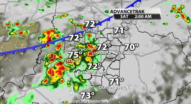
A cluster of storms out west will head toward our area overnight. After rain and storms through so much of the day, there's not much energy here left to work with. By the time those storms get here, they should maintain or weaken, not get stronger.
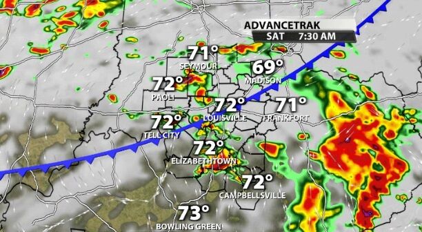
As the front actually gets into our communities Saturday, it is likely to spark more storms. Since that's first thing in the morning and we are expecting to to be cloudy again, the threat of widespread severe weather is low.
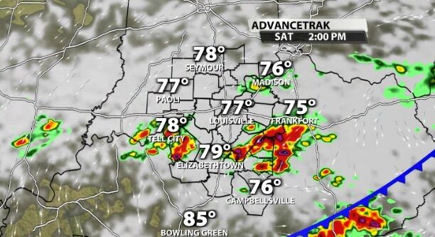
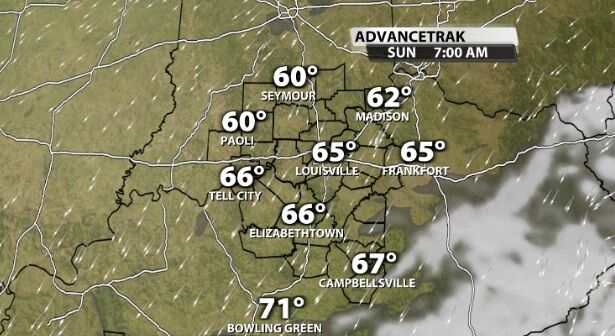
More storms pop up in the afternoon, but as we get closer to sunset, we will start to dry out. By Sunday morning the rain will be gone and so will many of the clouds.
Tune into WDRB News tonight at 10 to hear Chief Meteorologist Marc Weinberg's forecast, including how strong the overnight band of rain looks.


