Rain has been falling off an on in our area most of the day, and there's more on the way. Your weekend won't be a washout; in fact, we are seeing signals in the data that more of your weekend will be rain-free than previously expected.
From
To
We are still tracking rain and storms in our area but want to give you a look ahead at the next round of showers headed our way.
With rounds of rain in the forecast this weekend, let's take an early look at the timing to help you set your plans.
The week ahead brings several rain chances to our area, opportunities for more wintry weather to mix in when temperatures drop, and temperatures ranging from the 20s to 50s. This post will dig into the forecast in more detail for the next 48ish hours.
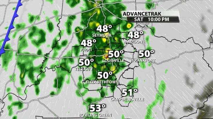
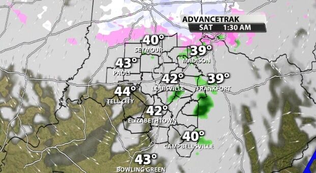
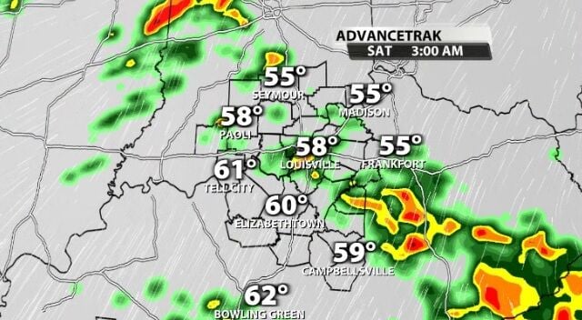
Light rain moved into our area Saturday evening with more on the way by Sunday. Overnight heavier showers will move in from the west bringing the good, soaking rain we need.

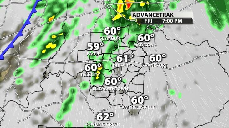
This weekend brings another round of rain, but the whole weekend will not be a washout. In fact, right now the timing of this rain is basically best case scenario for any outdoor plans you have this weekend.
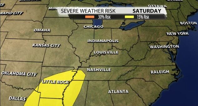
A strong low pressure center will barrel through our area this weekend bringing an active pattern that takes us from thunderstorms to snow potential. This post discusses what we are watching and what you may see from the weather this weekend.

Yes, there is rain in the forecast this weekend, but it will not washout your plans.
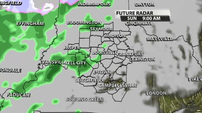
Rain returns to our area Sunday as a pair of low pressure centers head toward us.
The rain that's been hanging around most the day is part of a weather system that will drop temperatures heading into the weekend. After a few quiet days, we'll do this all over again leading into the Thanksgiving holiday.