
The week ahead brings several rain chances to our area, opportunities for more wintry weather to mix in when temperatures drop, and temperatures ranging from the 20s to 50s. This post will dig into the forecast in more detail for the next 48ish hours.
SATURDAY NIGHT
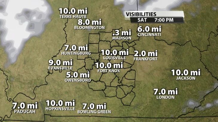
Visibility is dropping as fog sets in and drizzle develops. The atmosphere is saturated, so there is plenty of moisture in the air to support this through the night as long as the wind stays quiet. If the wind picks up, it will help mix out the fog.
SUNDAY MORNING
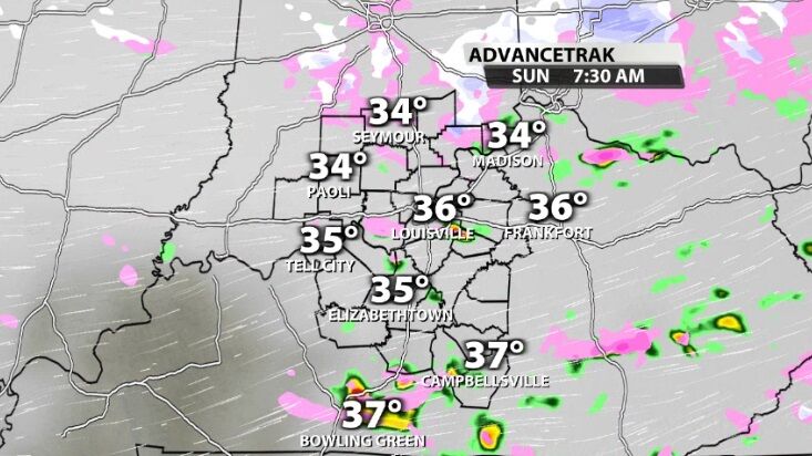
Overnight and by Sunday morning, some of this moisture will fall as more organized showers. Those will be mostly rain because the air is too warm and the precipitation too light to support snow. But where temperatures drop near or below freezing in southern Indiana, a wintry mix will be possible. This is most likely in our northernmost spots who should also be vigilant for freezing fog/drizzle while the wind is slow.
SUNDAY EVENING
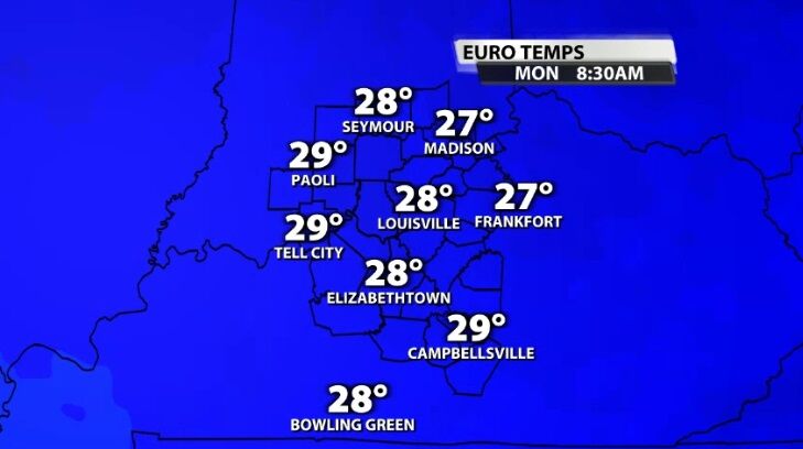
Sunday evening through Monday evening should be fairly quiet, though cold. Temperatures drop into the 20s across our area Monday morning while the atmosphere is drying out, so this cool-down won't bring us snow.
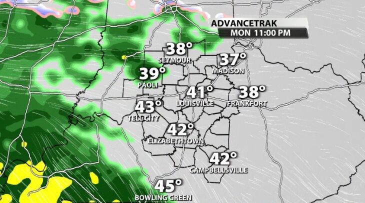
MONDAY
Activity ramps back up Monday night when rain returns to the area. This rain will continue off and on (mostly on) through Wednesday morning. As temperatures drop, we may see another round of a rain/snow mix, but let's get a little closer to that event before working to nail down those specifics.
Join us for WDRB News tonight at 10 to see the latest data on each system and hear my thoughts about these wintry-mix chances.


