
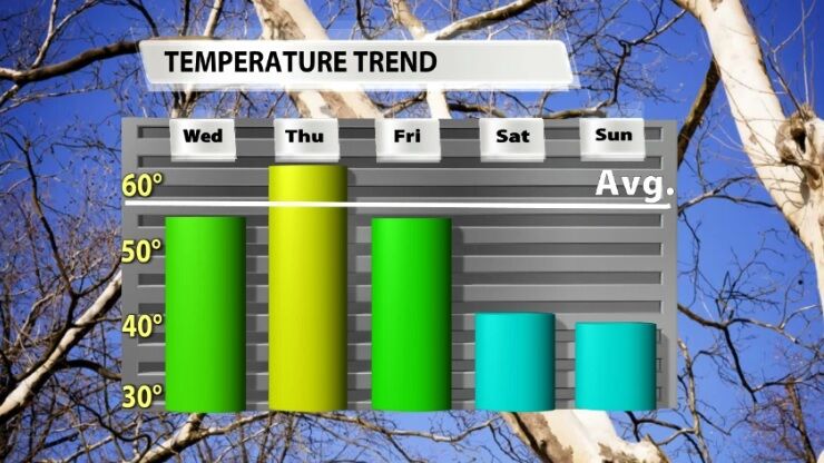
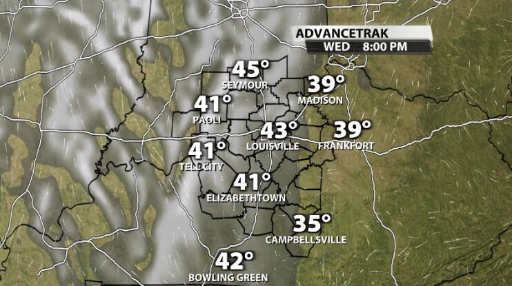
Temperatures feel less painful this afternoon as warmer air moves into the region. It won't last long, though. The next cold front arrives on St. Patrick's Day and brings some rain with it.
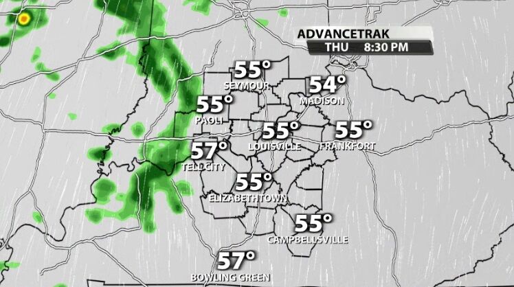
We won't see that rain until late Thursday night, so tonight and the daylight hours on Thursday stay dry with more clouds filling in above our heads.
Around sunset Thursday night, lighter rain starts to show up in our western communities.
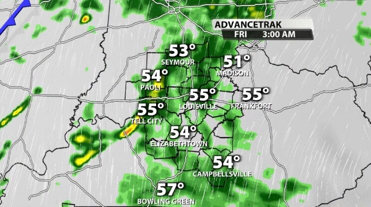
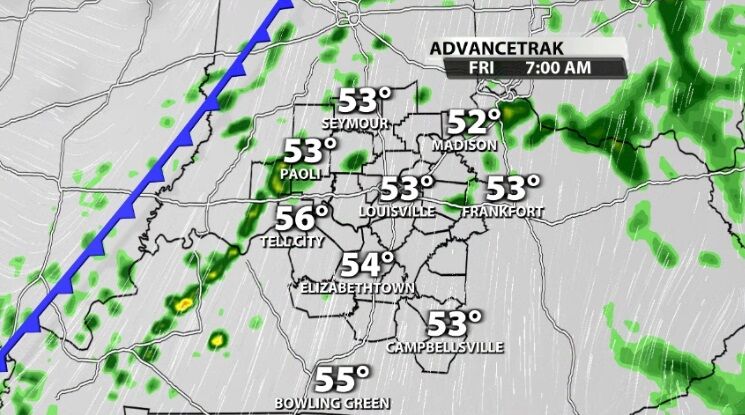
Overnight between Thursday and Friday the rain gets heavier and spreads across more of the map.
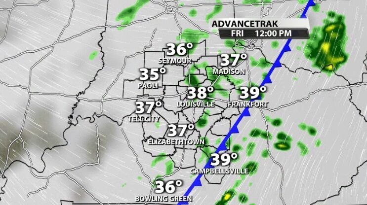
The cold front will pass through our communities during the day Friday bringing continued shower chances until the early afternoon hours.
By Friday evening the rain and cold front have moved east, out of our area, and the colder air starts to settle in. If you have festive plans that evening or over the weekend, bundle up but leave the rain gear at home.
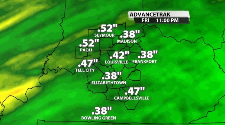
Most of you will see around half an inch of rain or less from this system on St. Patrick's Day. Tune into WDRB News tonight to see the latest data including timing and intensity of the rain.


