
We have been through an interesting month of weather. Most of it has been dry, but we have seen these heavy rain events about once every 10 days or so that have kept us out of worse drought conditions than we have at present. The data is starting to hint at a weather pattern change that could bring more consistent rain back to the area.
Changing Weather Pattern:
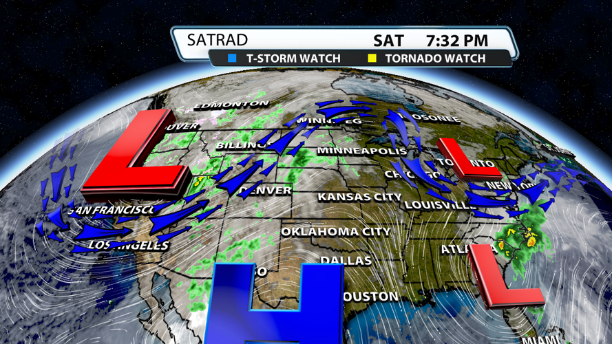
The jet stream across the US right now is showing a ridge controlling the center of the country through the Ohio Valley. For us, this has meant really nice, but dry weather.

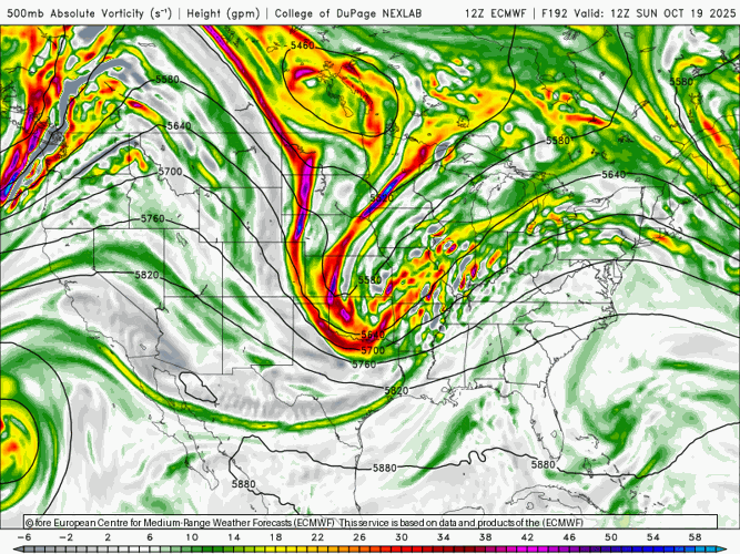
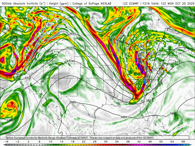
The changes we see later next week are showing up in various intensity in all of the major weather models. They are showing a far higher amplitude weather pattern with a strong upper level low moving across our area. Notice the highly reliable EURO model show the mid level low approaching on Saturday of next week.

By Sunday to Monday, it shows that low moving directly overhead. That means we would likely see a very nice opportunity for rain.

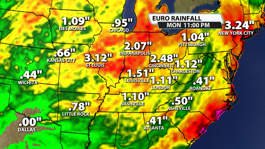
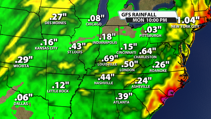
How Much Rain?
When we look at the data, we are seeing various amounts. Considering this is about a week or so away, this is not surprising. The GFS is a little weaker than the EURO computer model in its rainfall projection, but both are showing solid rain for the Ohio Valley. As you look at the data, note the model name on the top right part of the image.


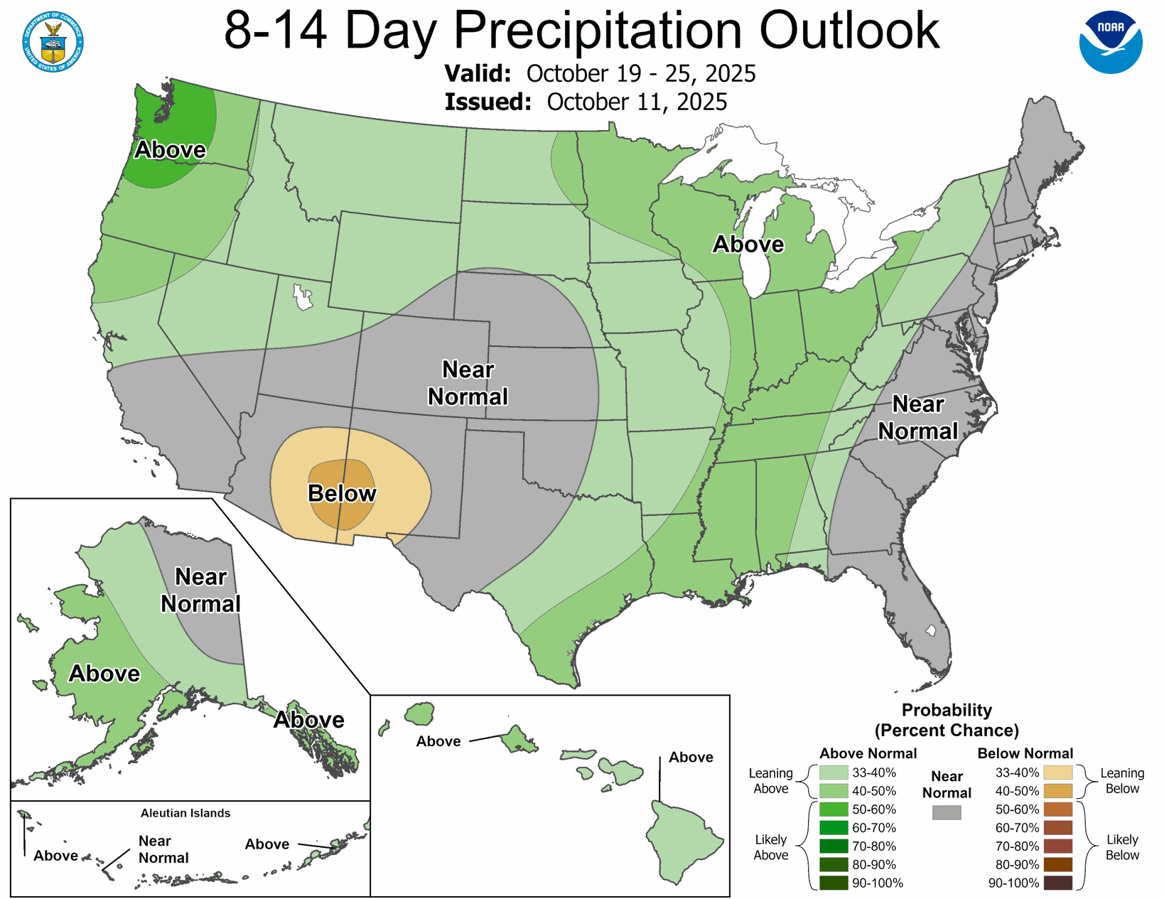
Unsurprisingly, CPC is noting wetter than normal probabilities for our area in their 6-10 day and 8-14 day outlooks. Why? Because this does appear to be a pattern change taking shape as we move toward the end of October.

The bottom line is that it does appear the long, dry weather pattern is coming to an end. The pattern shift should allow more frequent storms and better rain chances.