
As we mentioned in our previous blog, there is a chance early tomorrow morning that some of our area could get a quick glaze or so of freezing rain along a front that is moving through. You can read more on the specifics behind it on that link above.
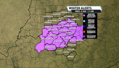
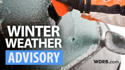
Due to this, the NWS in Louisville has now agreed and has decided to issue a Winter Weather Advisory for tomorrow morning due to the potential for slick travel during the morning commute. The advisory is in effect from 4 AM until 11 AM Wednesday morning.

Here's more info on the advisory from the NWS:
* WHAT...Precipitation is expected to develop across the advisory
area early Wednesday morning and will likely be in the form of
freezing drizzle and freezing rain. Some snow may mix after
sunrise. Additionally, road temperatures are expected to be well
below freezing overnight and what precipiation falls will likely
freeze on contact resulting in slick road conditions. Conditions
will improve by mid-late morning as surface temperatures warm to
above freezing.
* WHERE...Portions of south central Indiana and east central, north
central, northwest, and south central Kentucky.
* WHEN...From 4 AM EST /3 AM CST/ to 11 AM EST /10 AM CST/ Wednesday.
* IMPACTS...Plan on slippery road conditions. The hazardous
conditions will likely impact the Wednesday morning commute.


