
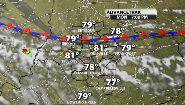
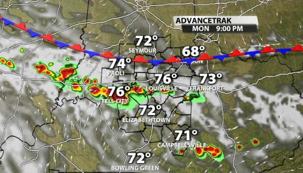
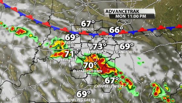
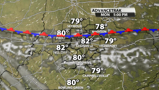
Our steamy and stormy pattern begins tomorrow with humidity rising for all, but storms will only impact some of us. A quasi-stationary front will be lined up along I-64 later in the day. That will in turn become the focus mechanism for thunderstorm development around 5-6 PM. Downpours and lightning are the two obvious threats. Updrafts will be strong enough to support hail cores, mostly 1" or less in diameter. Since the mid-level flow isn't strong, localized downburst winds can occur when a storm collapses. Bottom line, be on the look out for strong storms before sunset along and south of I-64. Storms simmer down after midnight as we lose heating...
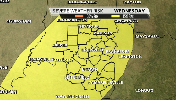
If we get severe weather this week, Wednesday afternoon poses the greatest threat. There will be one weakening wave of storms in the morning, then a stronger wave develops during the afternoon. While all modes of severe weather are possible, this appears to be more of a damaging wind threat than a tornado threat. Either way, stay with WDRB for updates about severe potential and details for Thunder Over Louisville!


