

It's been nice avoiding a lot of the cold air we normally see this time of the year and the cold that we saw earlier in the month, but mother nature is about to remind us that it is winter.
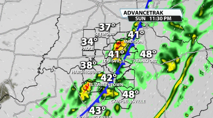
A strong cold front is set to roll into our area on Sunday night. The front will be moving in after a breezy Sunday afternoon where temperatures could climb into the low 70s and break a high temperature record of 70 on the nose set back in 2021.

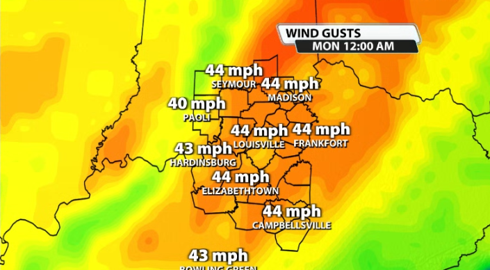
As the front rolls through, winds whip up. Wind gusts 40+mph are likely for many of us, with some isolated gusts going 50+mph. That is outside of any storms that roll in. The storms associated with the front should be in a weakening phase as they approach and will have limited fuel to work with, but there could be just enough where some could be on the stronger side west of I-65.

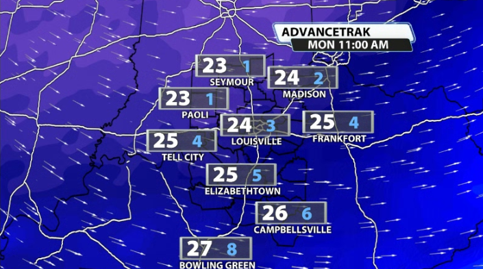
Temperatures crash almost immediately behind the front as the wind continues to be strong and they continue to plummet all night long and into Monday morning before eventually levelling out in the low-mid 20s. That's a near 50 degree temperature drop! With all of that happening overnight, don't be caught off guard with a completely different kind of air walking out of the door on Monday morning.
Wind chill values by Monday will likely be in the single digits as it remains breezy on Monday even with a decent amount of sunshine.
Strong to damaging wind gusts 40-50+mph will be the main impacts other than the temperatures drastically crashing.


