
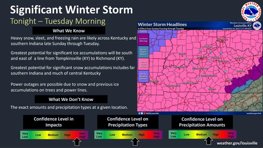
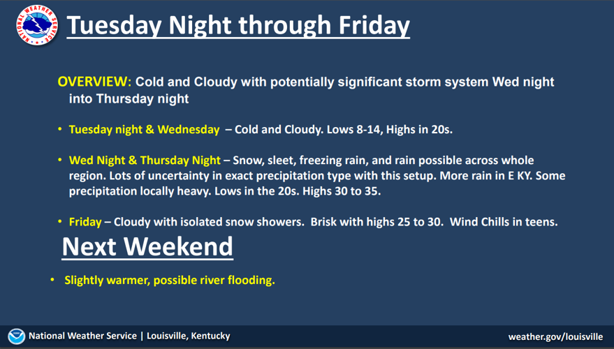
A winter storm system will bring two waves of wintry precipitation to the region tonight through Tuesday. There could be significant accumulations of snow, sleet and possibly freezing rain. The heaviest precipitation is expected to occur Monday afternoon into Monday night.
Greatest potential for significant ice accumulations will be to the south and east. Greatest potential for significant snow accumulations includes far southern Indiana and much of central Kentucky Power outages are possible due to snow and previous ice accumulations on trees and power lines. Exact amounts and precipitation types at a given location are still difficult to predict.

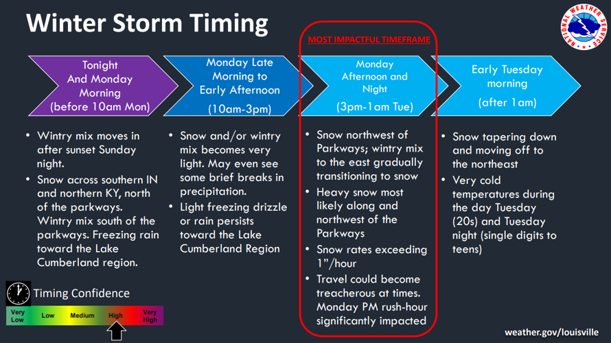
After sunset tonight, a wintry mix of snow, sleet and freezing rain will begin and continue to increase in coverage. Freezing rain, snow and sleet is most likely along and south of the Parkways, while snow and sleet is more likely to the NW. This will continue until mid-morning on Monday when there will be a brief break when snow and/or wintry mix becomes very light. May even see some brief breaks in precipitation. However, the most impactful timeframe will be Monday afternoon through Tuesday morning. Expect high snow rates, 1-2'' per hour are possible. Travel could become treacherous at times. Rush hour on Monday evening will be bad. This will taper off by early Tuesday morning and it will be very cold.

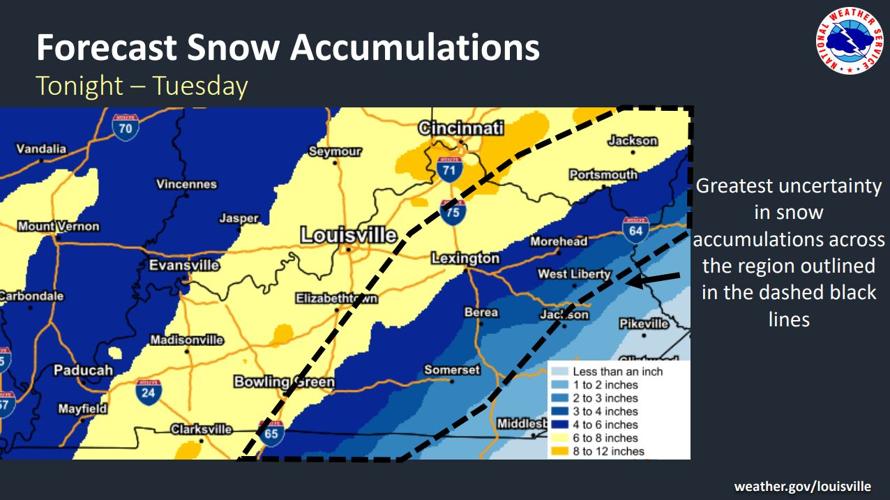
Expect significant snow accumulations 6-8'' with locally higher amounts will be likely. The greatest uncertainty in snow accumulations across the region outlined in the dashed black lines due to precipitation type concerns.

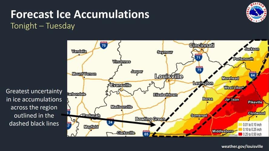
Ice accumulations will be greatest outside of the WDRB viewing area, but if you live south and east of the Parkways (Adair,

Looking ahead....


