
By now you have probably heard that we have severe risks the next couple of days in our area. There's been a lot of questions in regard to storm development and timing with these complex storms heading into our area. Let's dive into what we know now as we get closer to Thursday & Friday.
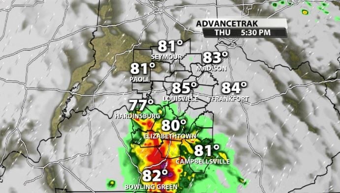
Thursday
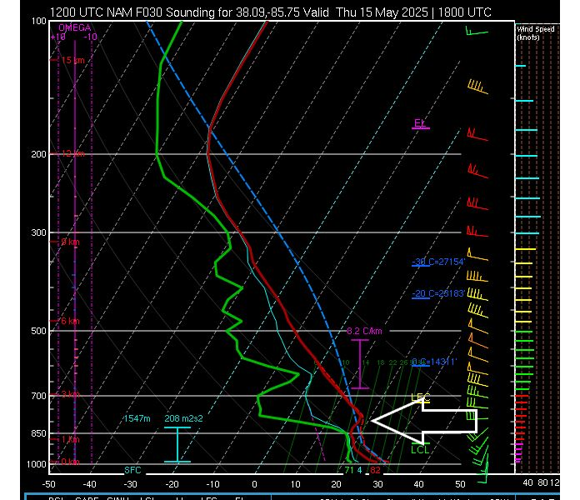
The one big factor that hasn't changed with Thursday is the fact that data still shows a very strong cap in our atmosphere on Thursday afternoon. Remember that a cap in the atmosphere is like a lid and can limit or in some cases completely prevent storm development. For more on exactly what a cap is, click here.
We can see that "cap" in the data for Thursday afternoon still in the atmospheric soundings (a vertical look at a sliver of the atmosphere at that particular time).

That sounding is for mid-afternoon on Thursday and should help prevent strong storms or maybe even storms at all from developing for most of Thursday.
With that being said, once we transition to late at night Thursday night (after midnight), the atmosphere has cooled some and the cap is not nearly as strong. This could allow for storms to get through into our area in stronger form and bring us a severe potential with large hail and damaging winds overnight and into early Friday morning.
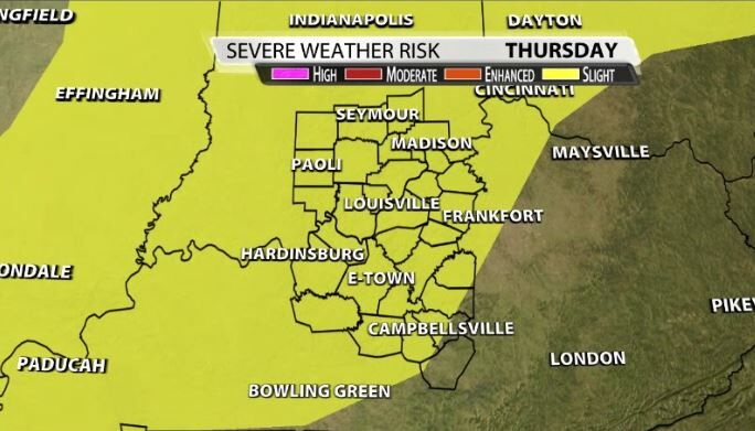
The SPC currently has a "slight" risk for almost our entire area for Thursday afternoon and Thursday night.
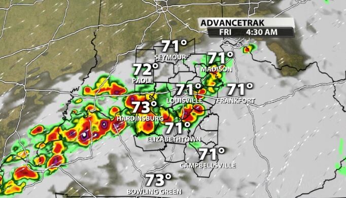
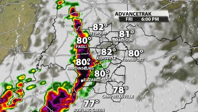
Friday
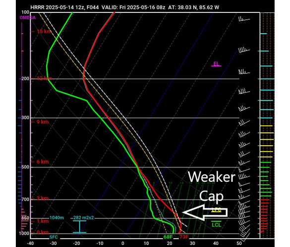
At this time and lurking into Friday morning, you can see on the sounding that the cap is not nearly as strong. This would allow for strong storm development to be more likely than on Thursday afternoon.

These storms have the potential to last through daybreak and into mid-morning. The timing is still uncertain and depends on what model you look at.
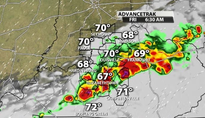
The problem is, is that the timing of the storms on early Friday morning will likely greatly effect more strong storms that could arrive Friday evening. The longer that the morning convection on Friday hangs around, the less time the atmosphere will have to reconvene itself and build back more storm energy for Friday night's wave.
That Friday night wave will have the potential to bring in widespread severe storms to our area if the morning convection leaves early in the day. If they do leave early on, there would likely be a lot of storm energy and wind energy available by Friday night.
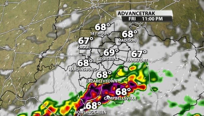
These storms would bring all modes of severe weather, with damaging winds and hail being the largest threat, but cannot rule out the chance for tornadoes as well. In regards to the hail & wind threat, there is a potential we could see very large hail in addition to more intense and destructive wind gusts. There is a high ceiling with the threat for Friday night to be completely forthcoming, but it will be highly dependent on what happens Thursday night into Friday morning, so that could change quickly.
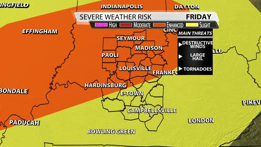
The SPC currently has our area under an "enhanced" risk for Friday. They also include the Enhanced area in a "hatched" area signifying the potential for *significant* severe weather Friday night.

Be sure to consistently check back in with the WDRB Weather Team on air and online as we continue to update you on the trends on possibilities with these storm systems.


