


There are two tropical systems, Marco and Laura, in the Caribbean and both are taking aim at the Gulf coast during the next few days. Portions of the Gulf coast are likely to experience a prolonged period of hazardous weather including hurricane force winds, life-threatening storm surge, and torrential rain for several days this week. This includes locations and cities in Louisiana, Texas and the Florida panhandle.
Remember when looking at the storm tracks in the images below, to look at the entire cone of uncertainty. The National Hurricane Center said not to focus on exact details of the track forecast, especially at the longer range as future adjustments will likely be required. Additionally, storm hazards will extend far from the center of the storm.

SUNDAY UPDATE:
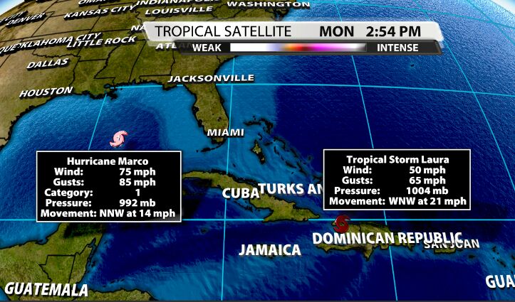
Marco has been upgraded to a hurricane with sustained wind speeds of 75 mph. Marco is actually expected to slightly decrease in intensity just before landfall as it moves into less favorable conditions. Landfall should be around Monday night into early Tuesday.

Tropical Storm Laura has increased slightly this morning as it produces extremely heavy rain over Hispaniola. It is not is expected to strengthen much over the next day as it will continue to move over land, like the rough terrain of Cuba. Once it moves into the Gulf of Mexico, it will strengthen rather quickly, potentially into a category 2 or 3 hurricane. Laura's track continues to be nudged farther to the west.
Marco and Laura are no longer expected to make landfall simultaneously. Laura will likely not make landfall until Wednesday or even early Thursday.


IMPACTS TO KENTUCKIANA:
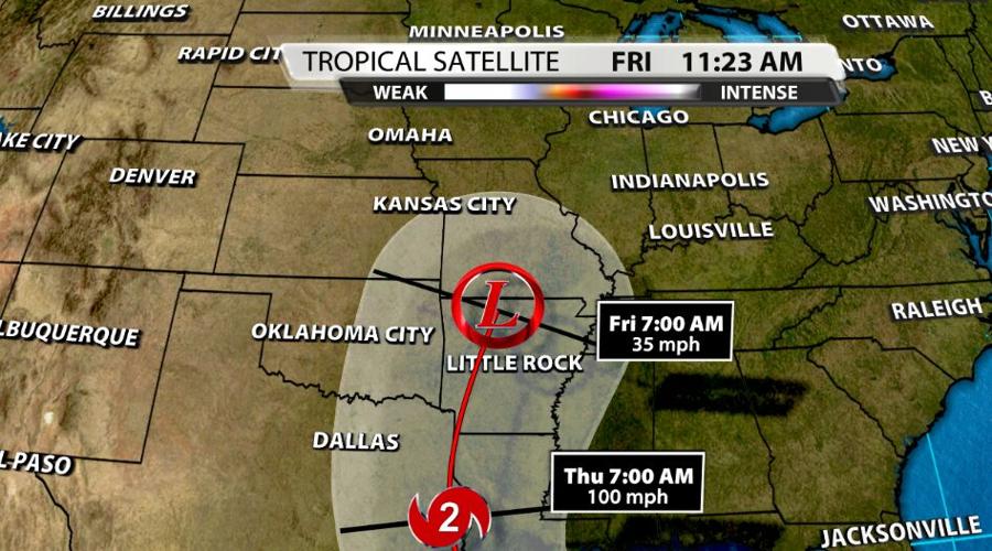
Due to the complexities of these systems, it is difficult to get too detailed about the impacts we could see in Kentuckiana. I will say it is looking more and more likely that the remnants of Tropical Storm Laura will move over or near the Ohio River Valley by the end of this week and next weekend. This is an early look at the extended forecast. Remember that the WDRB Weather forecast will be updated many times this week.

By the end of the week (Thursday - Saturday), the remnants of Laura look to be moving north toward the Ohio River Valley. The exact placement of the remnant low and axis of heaviest rainfall is still TBD (more on that below). There will also be another disturbance and cold front sliding through the area as well. This increases the likelihood of stormy weather by the end of this week. We will be watching for widespread heavy and tropical downpours, flooding, gusty winds, and spin ups.
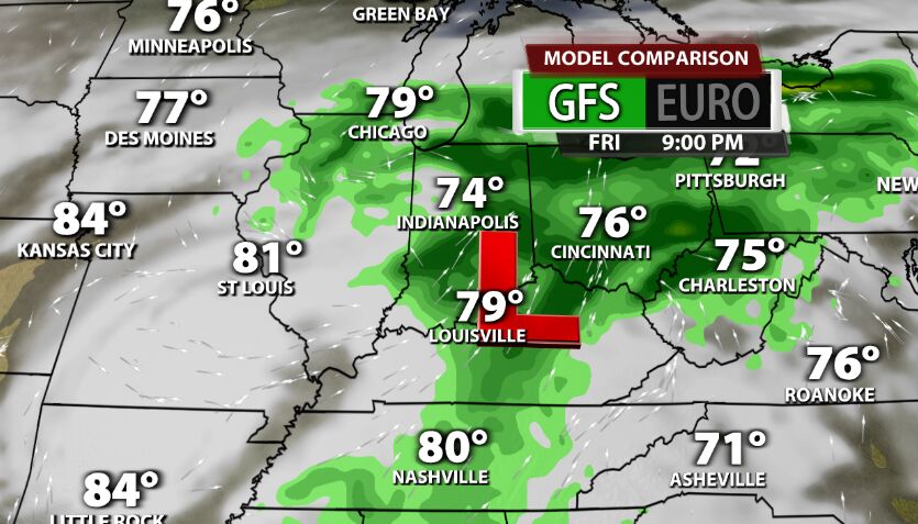
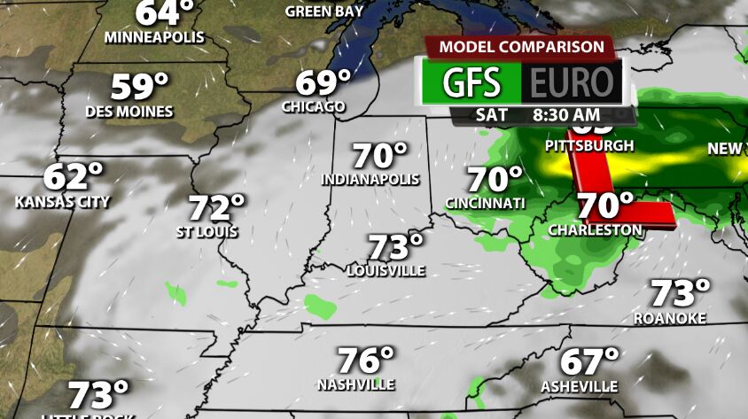
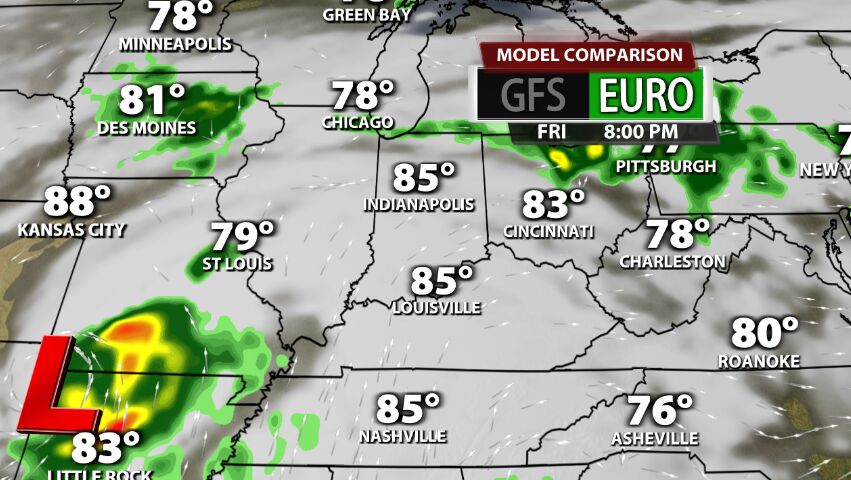
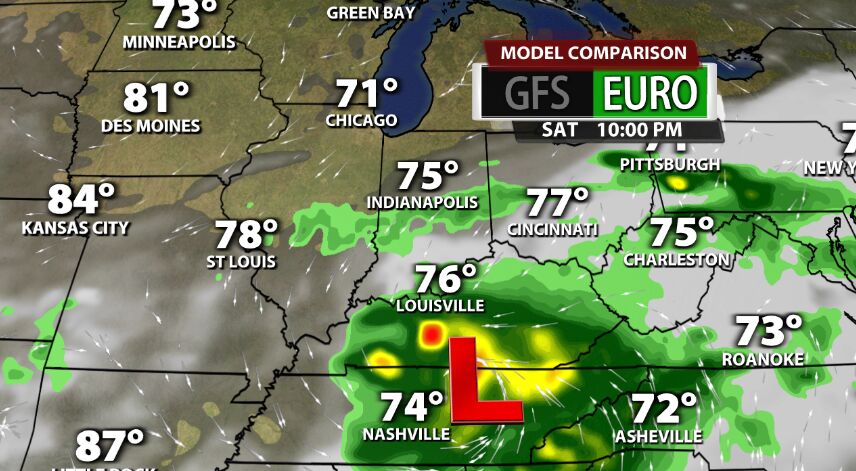
COMPUTER MODEL DIFFERENCES
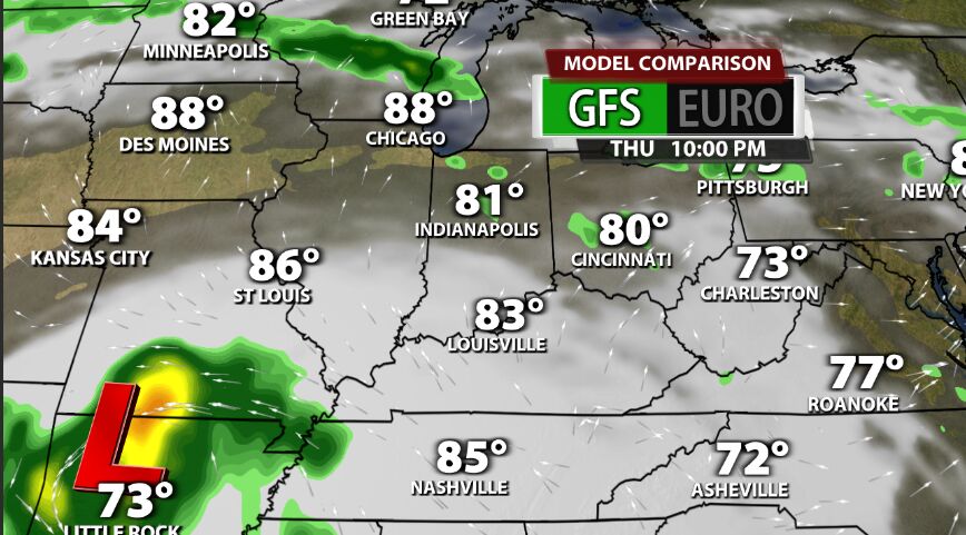
Below are two computer models, the GFS and the EURO. They both bring the remnants of Laura to Kentuckiana, but the low placement is in different areas and the timing of widespread rain is also different. Let's look at the GFS first.
GFS COMPUTER MODEL:
The GFS moves the remnant low essentially right over Kentuckiana late Friday and early Saturday. This means the most widespread rain would be on Friday while most of Saturday will be dry. Meanwhile the EURO keeps the remnant low a bit south of Kentuckiana. Additionally, Friday is mostly dry while Saturday is the soggy day.
Due to the uncertainty in the forecast, I started to put a few rain chances on Thursday and increased those POPs on Friday and Saturday. I think it is likely as we move throughout the week, the highest rain chance will fall on either Friday or Saturday.
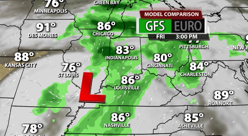
EURO COMPUTER MODEL:


