

Another quick hitting system is rolling toward our area for Tuesday. Some of us will get some minor snow accumulation and some will get just plain old cold rain. Let's dive into what the data is showing...
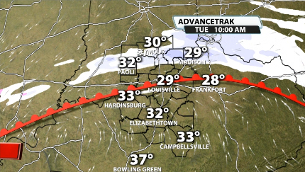
Model data brings in light snow for southern Indiana tomorrow morning and some flurries could make its way down to Louisville in the morning as well.
Moisture starts to fill in further as we go into the early afternoon and we quickly see a stark difference between cold rain and some wet/heavy snow falling in Indiana as it makes it way further south toward Louisville.
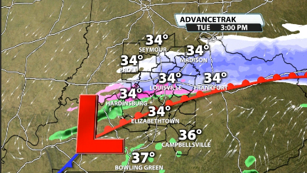
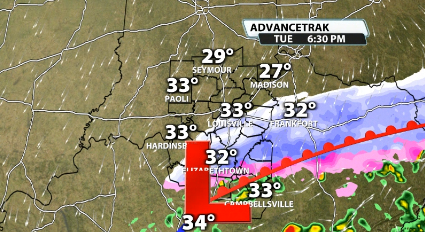
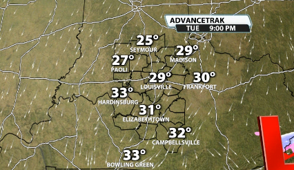
Louisville will likely see some wet and heavy snowflakes falling for a couple of hours mid-late afternoon on Tuesday. Cold rain looks like a good bet as you go further south into Kentucky. This gets out of here pretty quickly though, and we're already left with mainly flurries by around midnight.
There could be some sleet contamination in some spots as well, which would also cause for less snow accumulation. Here's our map for Monday afternoon and evening for Tuesday's snow...
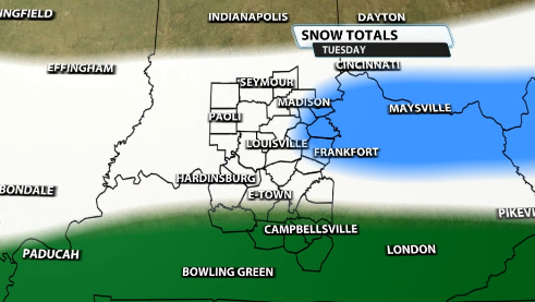
Notice areas like Louisville, Seymour, Paoli, Hardinsburg, and near E-town are in the "Up To 1". That means 0 to 1"
Areas like Eminence, New Castle, Shelbyville, and Campbellsburg are included in a 1-3" range.
Further south, areas like Leitchfield, Munfordville, Campbellsville, and Columbia are included in the "Mainly rain" area. These locations will likely be too warm for much/if any snowfall and/or accumulation.
This isn't a big snow maker, really for anyone, but road pavement temperatures are still below freezing for our area, so these can still stick and cause some issues.


