
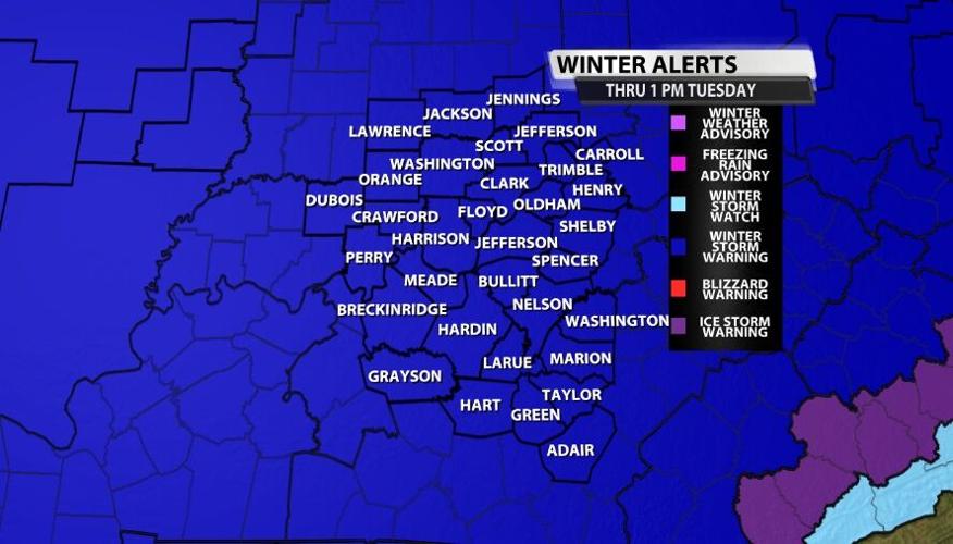


A Winter Storm Warning is in effect for all of our area until 1 PM Tuesday as rounds of snow will move through our area.

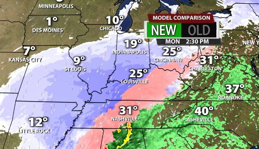
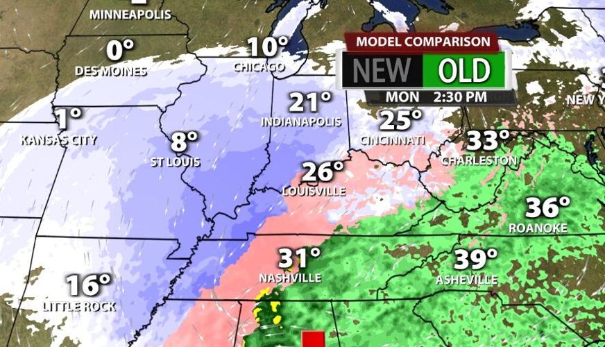
What is still changing? The two images below are the NAM model - the North American Mesoscale model. The first image is the older data and the one below it is the new data. We analyze the different runs side-by-side like this to see how the data is shifting.

A few things stick out that are worth noting:
- The newer run is colder.
- The newer run takes the "pure" snow (not mixed with as much sleet) farther south because the column of air is colder.
- The center of the system (the low pressure center) takes a track that carries it just a bit farther east in the new run. That positioning is likely what allows marginally colder air to wrap around the Low, cool the column more, and give us more snow.
- It's not enough to just look at two model runs; we have been analyzing each new run of each different model for days now to observe these patterns as they develop.

IMPACTS
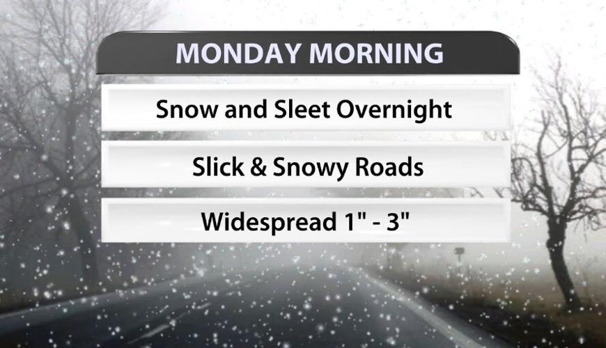
Monday morning you will wake up to accumulations of snow and sleet overnight. That will likely cause slick and snowy roads, especially for secondary and tertiary roads (not main highways that get treated more frequently).

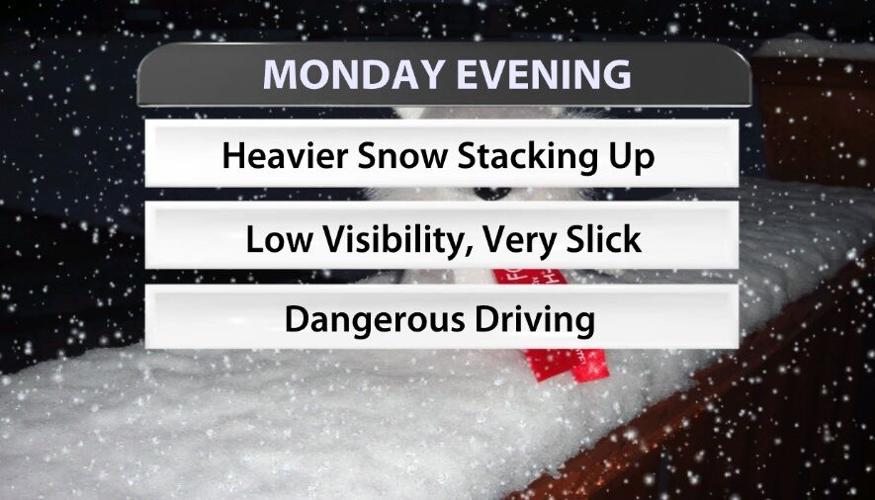
By the Monday evening commute, travel becomes much more dangerous. Heavier snow will be falling creating low visibility and very slick road conditions. That snow will also be accumulating fast enough plows will have a hard time keeping up with it on all roads, so please make a plan to be home by then.

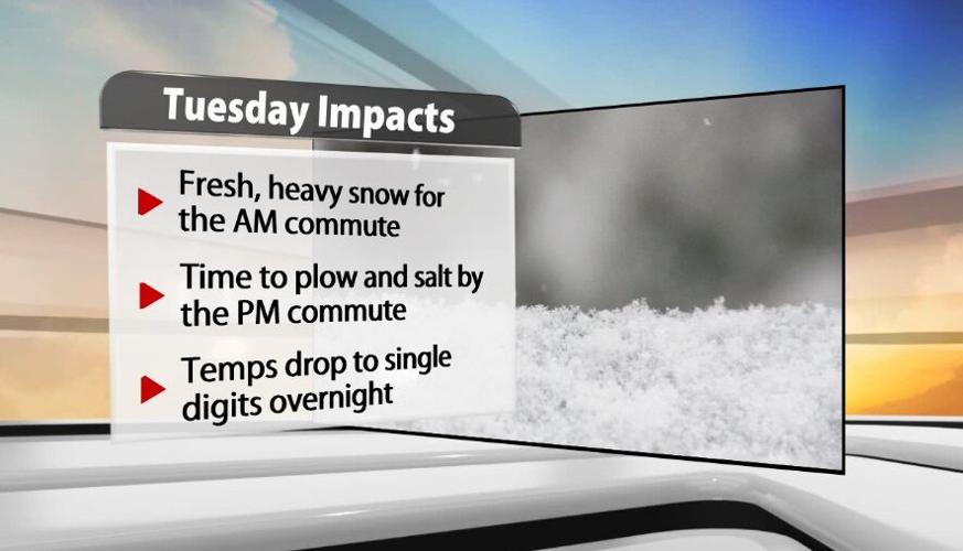
That fresh, heavy snow will still be around for the Tuesday morning drive. Through the day Tuesday, road crews should have a good opportunity to get roads more clear. The snow will have stopped falling by that point, so plows and salt trucks should be able to work well. With that said temperatures will drop into the single digits by Wednesday morning. With temperatures that cold, the salt starts to become less effective. Any water or snow still left on the road overnight will be a problem Wednesday morning.

TOTALS
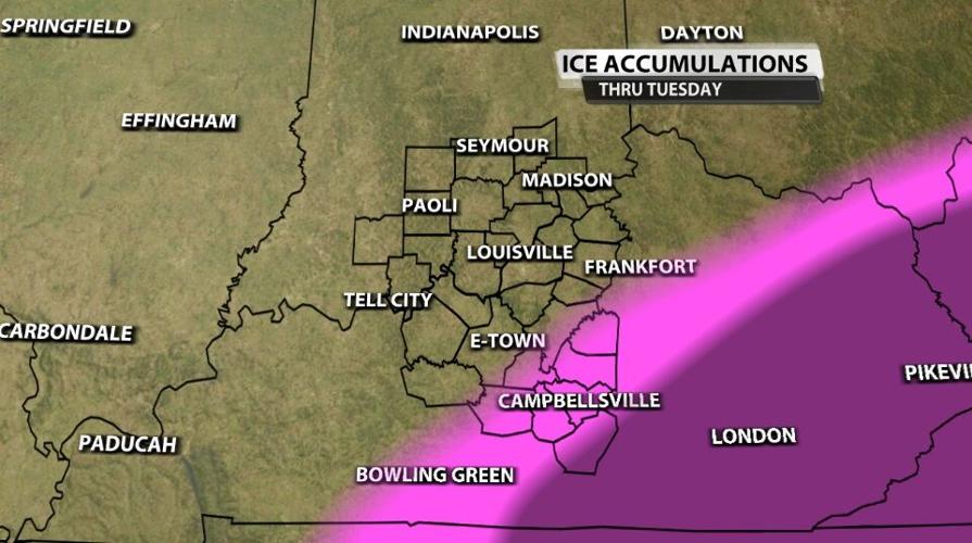
While ice is not the major threat like it was in the storm last week, the ice we do see will stack up on ice still on trees and power lines (and maybe your neighborhood street) from that previous storm. Most spots won't see measurable ice accumulation or it will be below a tenth of an inch. Adair county is where we want to watch for the potential to see more accumulating ice lead to more problems like downed trees or limbs and scattered power outages.

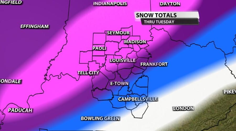
Snow is the bigger factor here with totals adding up fast. The first round of snow (overnight Sunday into Monday morning) will generally bring 1"-3" and many communities around the Ohio River and south will have sleet mixing in with the snow. The taller snow totals will add up Monday night in the second round. The pink shading in the image below is where we expect the highest totals because the snow will be the "purest" - the least contaminated with sleet. The purple shows where more sleet will mix in and cut into the snow accumulation a little bit. The blue and white shaded areas should see less than 6" of snow and sleet accumulate total between the two rounds.

Tune in to WDRB News tonight at 10 to see the latest totals maps and updated timing for the winter storm. THE NEWS WILL AIR ON WBKI AT 10PM.


