Rain and sleet showers have moved into most of our communities now, so may of you are asking when this will change over to snow.
From
To
The week ahead brings rounds of wintry mix to our area, potentially icy mix. While on their own none of these will be a major winter storm for our area, each will bring different impacts to our communities. That's what we will walk through here: the timing of these early rounds and what impacts they bring to which areas.
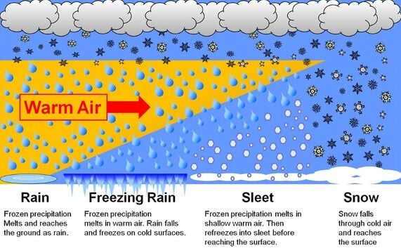
In Kentuckiana, we see all different kinds of weather and precipitation types. We get it all from severe thunderstorms to blizzards! We will see snow, rain, sleet, freezing rain, graupel, and hail...but what is the difference between all of these main precipitation types? Let's explain!
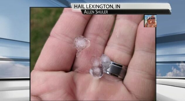
A few of our communities have seen small pieces of ice fall from the sky in the last 24 hours leading to the question "what is this?" One viewer asked Thursday if it was sleet or hail which is a great question to ask!

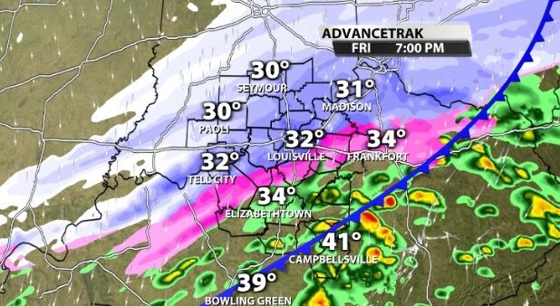
The National Weather Service hosted a conference call for their partners Wednesday afternoon to discuss the winter storm that will start to impact us Thursday.

The National Weather Service has issued a Winter Storm Warning for Adair county and a Winter Weather Advisory for several of our other WDRB communities.

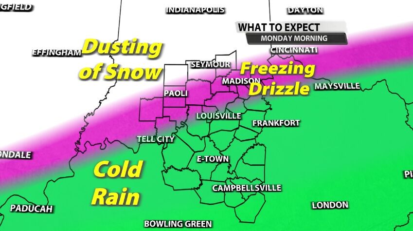
We just wrapped up another call with the National Weather Service office in Louisville to discuss their final thoughts on the winter weather that will impact *part* of our area Sunday. Here's what we discussed with them:

We just wrapped up a conference call with the National Weather Service about the potential for winter weather this weekend and the impacts in our area. Here's what we talked about:
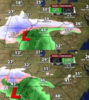
There is a lot of buzz about snow potential in our area this weekend, but it would be smart at this point to temper your expectations. When you see this much discrepancy between models a few days before a potential winter event, it's important to look deeper at what is causing them to show such different outcomes. That's what we will do today then look closer at the most likely scenario(s).

In Kentuckiana, we see all different kinds of weather and precipitation types. We get it all from severe thunderstorms to blizzards! We will see snow, rain, sleet, freezing rain, graupel, and hail...but what is the difference between all of these main precipitation types? Let's explain!