
The week ahead brings rounds of wintry mix to our area, potentially icy mix. While on their own none of these will be a major winter storm for our area, each will bring different impacts to our communities. That's what we will walk through here: the timing of these early rounds and what impacts they bring to which areas.
ROUND 1
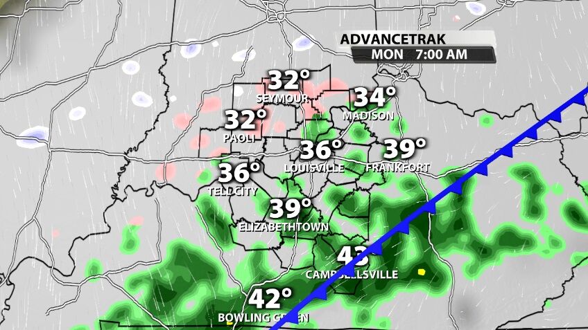
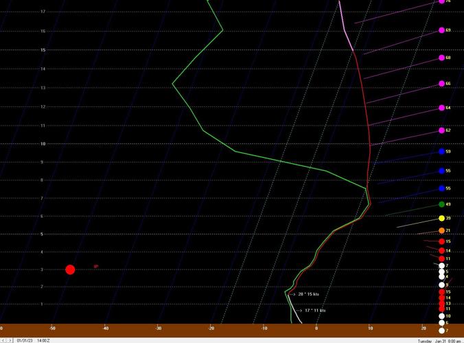
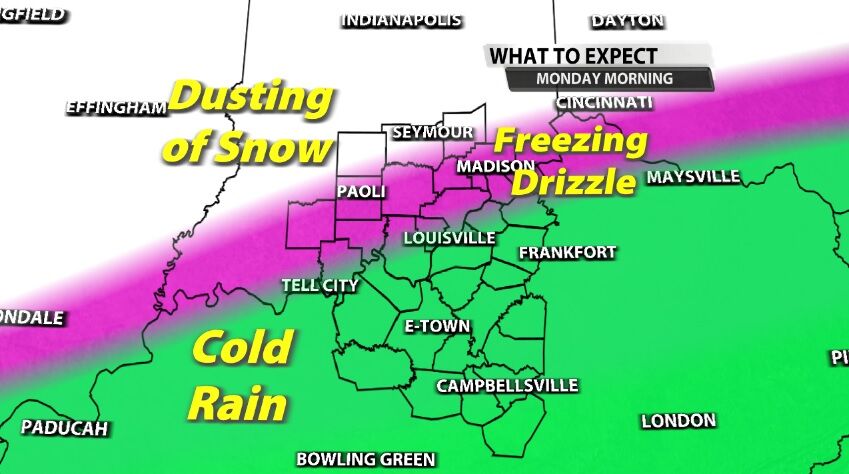
Sunday night the precipitation type (called p-type from this point on) stays mainly rain as temperatures drop out of the 40s into the 30s. By Monday morning our northern communities should see air temperatures at or below freezing which would allow the p-type there to change from rain to light snow and freezing drizzle.
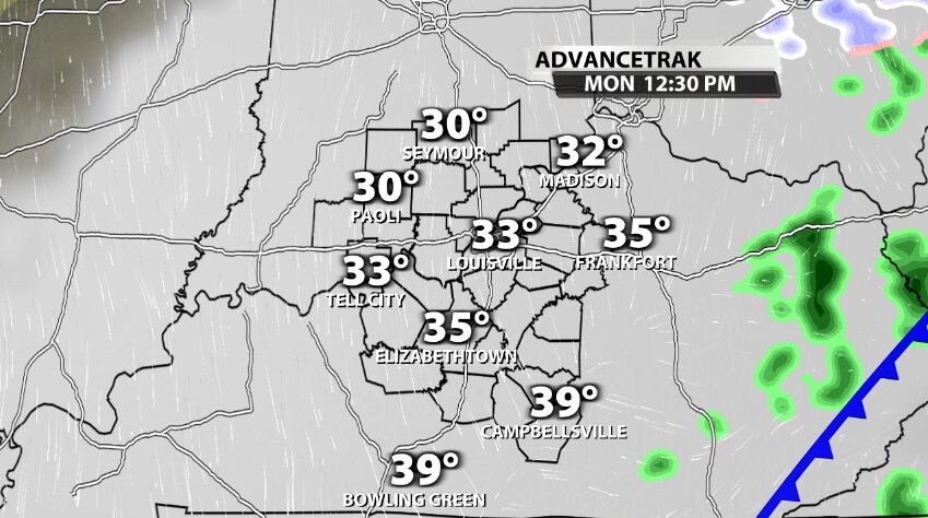
That change-over will be tough for Kentucky to do because temperatures south of the Ohio River should stay slightly above freezing, meaning you keep a rain p-type until this moisture moves out in the early afternoon.
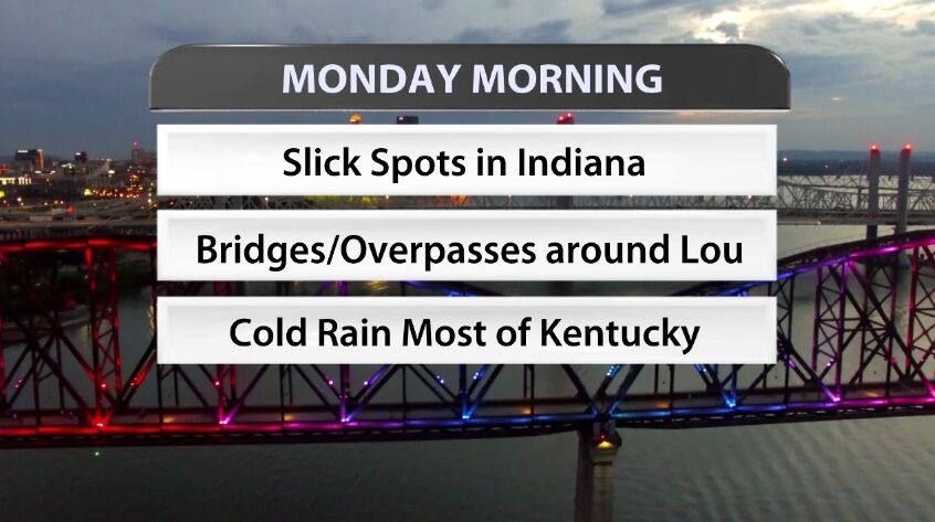
For Monday morning our communities around the Ohio River and to the north should expect to see a few slick spots, especially on bridges and overpasses. For the Louisville area, remember roads right next to the Ohio River tend to get colder, especially the elevated highways. That might be an area where slick spots develop quickly if a frozen p-type falls there.
ROUND 2
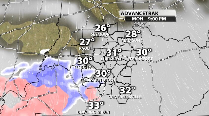
This second round of wintry mix has the most moisture in it of any of our rounds at this point (which really isn't saying much), so this is the one that looks like it could present more issues. A mix of snow, sleet, and freezing rain will slide in quickly from the west Monday night through Tuesday morning.
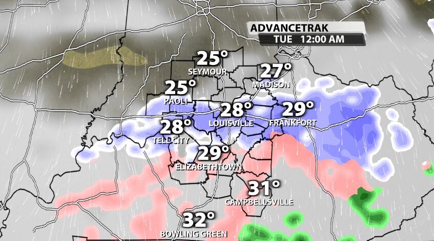
This is an interesting set up because you normally see snow OR freezing rain but not both based on where the snow is growing and how warm the air is that is has to fall through to get to us. This is being created by a thin layer of cold air and moisture relatively close to use here at the ground, as opposed to thousands of feet above our heads like normal.

With such a shallow layer to work with, snowflakes won't be able to form everywhere. Where they can't form, rain can form but temperatures will be below freezing so that would come to us as freezing rain. If snowflakes can form, they fall through cold air and reach us as snow.
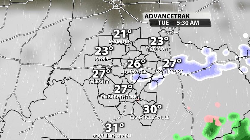
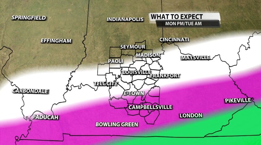
In the map below, the white shading represents where accumulating snow will be possible Monday night through Tuesday morning. This should be less than one inch of snow, but this stripe shows the difference between accumulating snow in this area and just a dusting or less farther north. The green shading to the south is rain, and the pink shading represents the potential for accumulating ice through freezing rain. At this point most of you should see less than 0.15" of accumulation. For reference above 0.10" is where we start to see some impacts, but you generally need more than 0.25" to cause more issues on roads and with power outages.
There is a third round moving in Tuesday night through Wednesday morning that we will focus more on in the coming days. In fact we might also briefly see some wintry mix Thursday morning if temperatures can drop low enough, but at this point that's a strong "if." Please remember that the difference of just one degree or even ten miles radically changes a forecast like this in a way we don't see from all-rain systems. The forecast will shift slightly in the coming hours and days; that means we are getting better data and able to give you a more accurate forecast. That also means you should keep checking the forecast to make sure you have the best information to make the decisions you need to make. Basing decisions about Thursday off of this blog post written Sunday night will likely end with you getting frustrated. Check in again Wednesday if you need to make a decision for Thursday to avoid some of that unnecessary frustration.


