
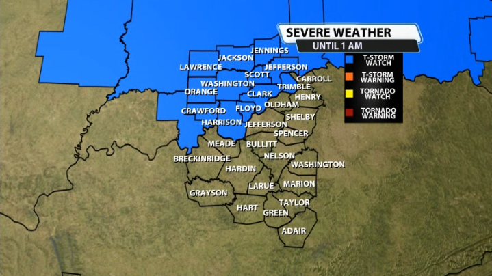
The Storm Prediction Center has issued a severe thunderstorm watch for part of our area ahead of the cold front that will roll through tonight and overnight. Here's who's included...it's in effect until 1 AM ET.
Here's more info on the watch from the SPC:
* Severe Thunderstorm Watch for portions of
Southern Illinois
Central and Southern Indiana
Northern Kentucky
* Effective this Sunday night and Monday morning from 615 PM
until 100 AM EDT.
* Primary threats include...
Scattered large hail and isolated very large hail events to 2
inches in diameter possible
Scattered damaging wind gusts to 70 mph possible
SUMMARY...Strong to severe thunderstorms are expected to develop
this evening near/just north of a southeast-moving front, with
unseasonably steep lapse rates and strong deep-layer winds being
supportive of severe storms capable of large hail and damaging
winds.
The severe thunderstorm watch area is approximately along and 60
statute miles north and south of a line from 20 miles west of Mount
Vernon IL to 55 miles south of Muncie IN. For a complete depiction
of the watch see the associated watch outline update (WOUS64 KWNS
WOU4).


