
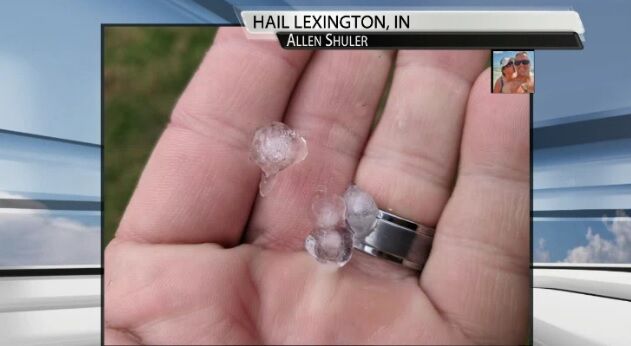
A few of our communities have seen small pieces of ice fall from the sky in the last 24 hours leading to the question "what is this?" One viewer asked Thursday if it was sleet or hail which is a great question to ask! This picture came in Wednesday from the gusty showers that moved through Lexington, Indiana. It does show hail; we know that because of the inner circle surrounded by an outer ring and that it's holding together in this person's hand.
Here's a quick video explanation about how hail forms:

When it comes to thunderstorm damage we typically associate that with strong winds or tornad…
There is an updraft, a column of rising air, inside of a storm. That updraft carries these pieces of ice or supercooled water up into the part of the cloud that is colder than freezing. More ice and supercooled water stick to that existing piece to form a larger hailstone. The hail then gets a little bit heavier, drops down in the cloud, and is swept up again by the updraft until it becomes too heavy for the updraft to support. That's the point at which hail falls to the ground. These small hailstones from Wednesday tell us the updrafts were only strong enough to support one additional trip up in the cloud before they fell down. The storms did not grow very tall Wednesday (which we know by looking at our cameras around the area and at "echo tops" - a radar product showing how high into the sky the storm reaches) which would also point to an updraft that wasn't very strong.
On Thursday, though, this gets a little more complicated. We weren't sent any pictures but did get a report of something small and frozen falling in Scottsburg, Indiana, Thursday afternoon asking if this was sleet or hail. Sleet falls when a snowflake forms high up in our atmosphere, falls through a layer of warm air and partially melts, then falls through another cold layer (with temperatures below freezing) so the part that melted refreezes. Sleet falls down while hail can move up and down in a cloud for an extended period of time building those rings or layers around the initial piece of ice. Understanding that, what you saw Thursday was likely also hail from those gusty showers that moved through. Without knowing the temperature profile above our heads, though, it's possible this could have been sleet.
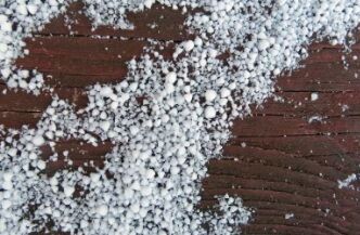
We also need to give an honorable mention to graupel, another form of ice that falls from the sky. Graupel forms when supercooled water freezes onto something like a snowflake or dust particle in the atmosphere. This is also called "soft snow" or "snow pellets" and falls apart more easily when handled. If you want to get super technical, the American Meteorological Society says in order to be classified as hail, the pellet must be at least 5 millimeters in diameter. Graupel can be smaller than that, so what we saw was likely too big to be graupel. However small hail stones, sleet, and graupel are all very similar which makes it hard to say definitively what you saw other than small pieces of ice falling from the sky. In my humble opinion, I would say it was hail Wednesday but without seeing pictures of what fell Thursday, it's tough to be specific. I would be surprised if the updrafts Thursday in our area were strong enough to support hail, so I would lean toward graupel or sleet.


