
We just wrapped up another call with the National Weather Service office in Louisville to discuss their final thoughts on the winter weather that will impact *part* of our area Sunday. Here's what we discussed with them:

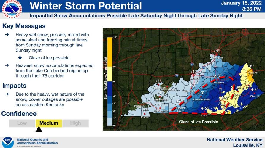
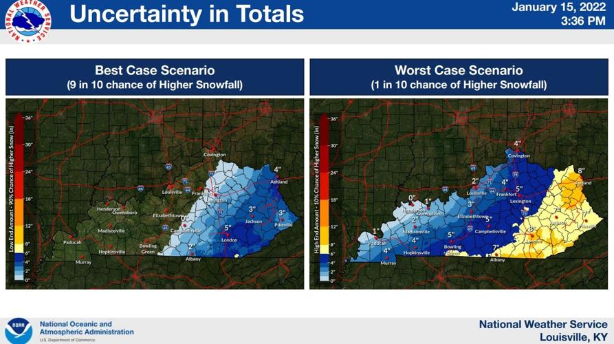
We are expecting a heavy, wet snow with some sleet mixing in. The sleet could lead to a glaze of ice in the beginning before the precipitation changes over to all snow. Since the precipitation starts mixed (sleet and snow), the exact outcome is harder to be confident in, which is why NWS Louisville is keeping their confidence on the low end of medium.

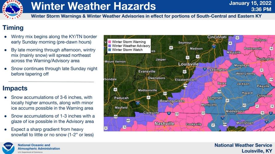
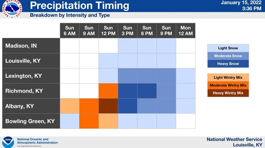
The heaviest snow looks to stay around the Cumberland parkway area and spreading over the I-75 corridor. Impacts in our area are most likely east of I-65. Communities west of I-65 will largely miss out on this system. This will all start in our area after midnight Sunday morning in southern Kentucky. Through Sunday morning it will spread toward the northeast before tapering off Sunday night.

If you are in the Warning area (Adair county), we are expecting higher snow (and ice) accumulations for you. In the Advisory area, you will see less snow - potentially 1"-3" according to the NWS forecast - and potentially a glaze of ice. Totals and type of precip still vary because there's a bit of warm air at play here. There will be spots that see bursts of heavy snow where totals really start to stack up. There will be a tight snow gradient. One spot with get nothing, but if you drive 20 miles to the east, you will find a community that gets several inches of snow accumulation. NWS did say there's a potential for snow in the Warning area to be on the lower end (4"-5") but with sleet coming in, too, things could get dicey.

Since this snow will be heavy and wet, as it hangs on powerlines and tree branches, there could be some power outages where we see more snow. The heaviest snow looks most likely Sunday afternoon, but the position of it will be harder to forecast this far in advance.

Tune into WDRB News tonight at 10 to see my updated forecast with timing and totals after looking at the latest data. We are expecting another small system Monday to bring more snow to some of the communities that didn't get it from the Sunday system. We will talk more about that on the news tonight.


