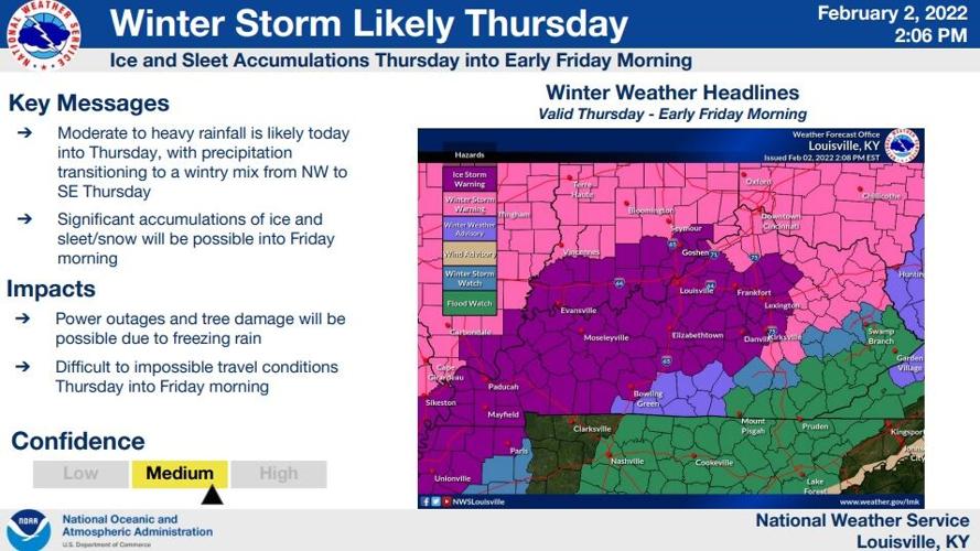
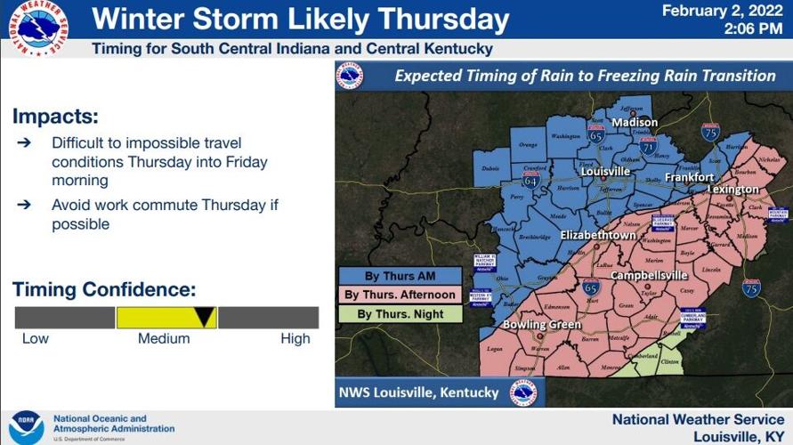

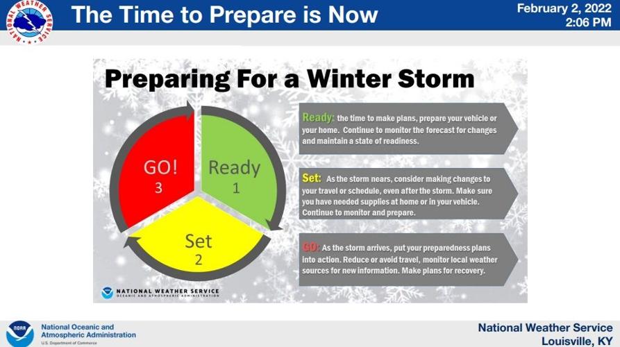
The National Weather Service hosted a conference call for their partners Wednesday afternoon to discuss the winter storm that will start to impact us Thursday. The wintry stuff starts overnight between Wednesday and Thursday in our northern communities and will be closer to sunrise around the Louisville metro.

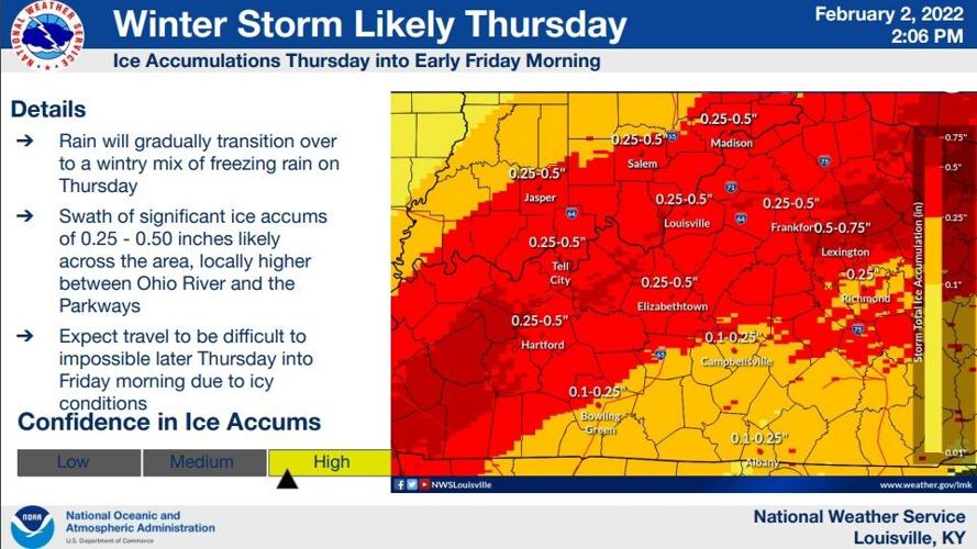
The trends in data today have been colder and farther to the south, so the National Weather Service office in Louisville has adjusted their ice and snow totals accordingly and says "significant accumulations of ice are expected."

It's important to understand the impacts and how bad they will be from the ice. When we talk about ice accumulation, totals closer to 0.10" will lead to some tree limbs down and sporadic power outages. That much ice will be impactful and travel will be hazardous. As your total climbs closer to 0.25", you should expect quite a few power outages with a lot of impacts and hazardous travel. On the upper end (0.50"-0.75"), you should expect widespread power outages. The NWS says power outages are "likely" and travel conditions will become "impossible at times."
As you consider any potential travel, there is roughly a 2-3 hour lag between ice starting to accumulate and seeing road impacts. Those road impacts will start to become more likely in Louisville around midday.

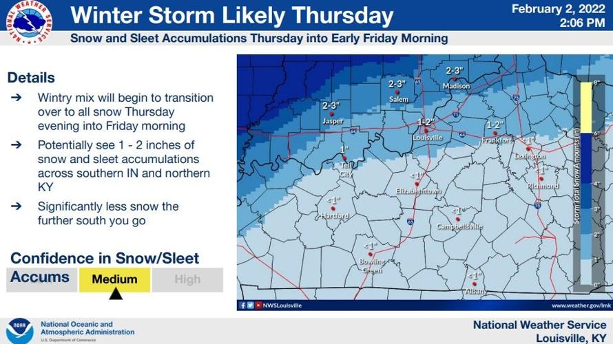
NWS says freezing rain and ice accumulations are most concerning plus we will be a bit windy Thursday and Friday. As ice accumulates on trees and weighs them down, a breeze will make it easier to break off limbs and lead to power outages. With sleet and snow on top of the ice, NWS expects this to be a pretty impactful event but does not compare it to 2009.

If you don't have to be out, if travel is not necessary for you, don't travel. It will make it harder for first responders and crews working to treat the road and restore power to do their work. The the only reason confidence is shown in medium is exact timing and amounts. The NWS has high confidence this will be an impactful event in our area. There is some data showing in our northern communities, the transition to sleet and then snow may come sooner which would cut down on how long you are seeing freezing rain. That would also drop your ice totals a bit and raise your snow/sleet totals, but we will keep you posted as the forecast shifts.

There is prolonged cold behind this system, limiting future melting. It will take time to melt what does accumulate on trees, elevated surfaces, and even roads. As you think about the potential for losing power, think about how cold the air will be after the winter weather leaves.

It's also worth noting some minor river flooding may be possible in the Green River basin, in particular, with all the rain falling in southern Kentucky.


