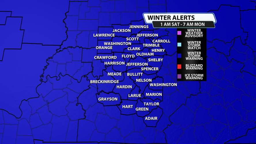


...WINTER STORM WARNING REMAINS IN EFFECT FROM 1 AM EST /MIDNIGHT
CST/ SATURDAY TO 7 AM EST /6 AM CST/ MONDAY...
* WHAT...Heavy mixed precipitation expected. Total snow
accumulations between 7 and 13 inches and ice accumulations around
four tenths of an inch.
* WHERE...Portions of south central Indiana and central Kentucky.
* WHEN...From 1 AM EST /midnight CST/ Saturday to 7 AM EST /6 AM
CST/ Monday.
* IMPACTS...Power outages and tree damage are likely due to the ice.
Weather Forecast | Live Cams | Radar | Share Photos & Videos
Travel could be nearly impossible.
PRECAUTIONARY/PREPAREDNESS ACTIONS...
If you must travel, keep an extra flashlight, food, and water in
your vehicle in case of an emergency. In Indiana, for Indiana Road
Conditions please visit http://511in.org In Kentucky, for Kentucky
Road Conditions please visit http://goky.ky.gov

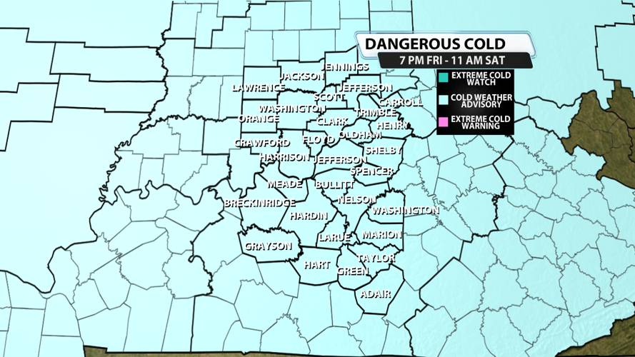
...COLD WEATHER ADVISORY IN EFFECT FROM 7 PM EST /6 PM CST/ THIS
EVENING TO NOON EST /11 AM CST/ SATURDAY...
* WHAT...Very cold wind chills as low as 11 below expected.
* WHERE...Portions of south central Indiana and central Kentucky.
* WHEN...From 7 PM EST /6 PM CST/ this evening to noon EST /11 AM
CST/ Saturday.
* IMPACTS...The cold wind chills as low as 10 below zero could
result in hypothermia if precautions are not taken.
PRECAUTIONARY/PREPAREDNESS ACTIONS...
Use caution while traveling outside. Wear appropriate clothing, a
hat, and gloves.
Winter Weather Coverage:
Kentucky declares state of emergency as major winter storm approaches
Officials outline Louisville snow response as region braces for weekend winter storm
Winter weather | Check driving conditions across Kentucky and Indiana


