


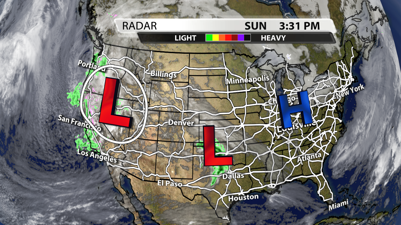
After a chilly weekend, it's time to turn our attention to a warmer more rainy work week. High pressure has been keeping us chilly for the last couple of days, but the circled area of low pressure over the Rockies will bring us our next chance for showers and storms.
Satellite & Radar made in WDRB's WSI graphics system
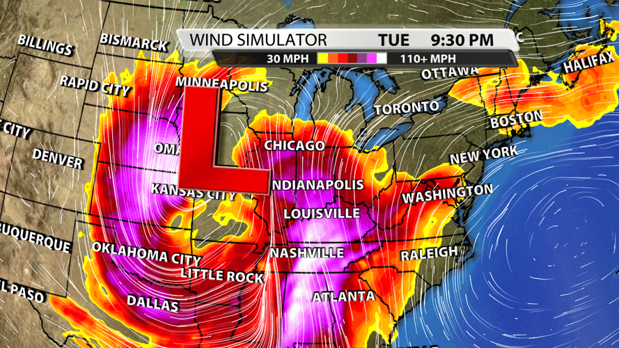
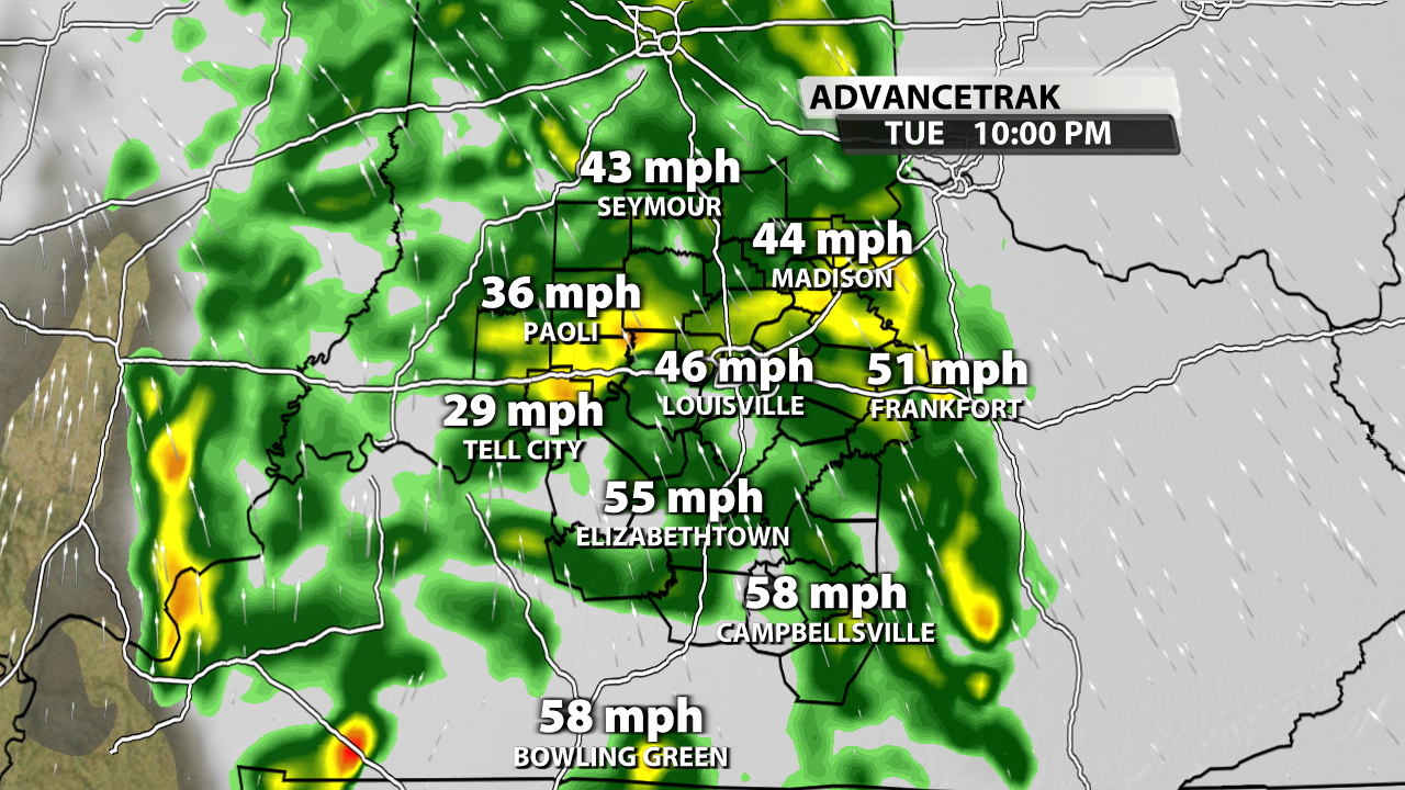
The rain will likely arrive Tuesday evening after a very warm but dry afternoon. Winds will be increasing throughout the day, and although storms themselves might not produce damaging wind gusts, the overall system is so powerful that there will be widespread 40 - 55 mph gusts Tuesday afternoon into Wednesday morning. Some gusts could top out around 60 mph.
AdvanceTrak made in WDRB's WSI graphics system
The reason for the extremely high wind gusts is the insane wind speed at the 850 mb level. These winds will top out close to 100 mph at times, and that could translate down to the ground as 50+ mph winds. So even if we don't have "severe storms" our wind will be high enough that a Wind Advisory will be issued and a High Wind Watch is not out of the question.

ECMWF 850 mb winds graphic made in WDRB's WSI graphics system
There are a couple of limiting factors that are keeping us out of a significant severe weather threat: a lack of instability and relatively low dew points. Dew points will be around 50 degrees, but they typically need to be around 55 degrees to be conducive to a severe weather setup. More specifically, CAPE (energy) values at the surface will be very low. Without the instability to created surface-based storms, we anticipate the setup to be primarily widespread gusty winds instead of embedded supercells within the line of showers and storms. With this in mind, the Storm Prediction Center (SPC) has taken the "Slight Risk" category (yellow color) for severe weather even farther away from our area. Therefore, our confidence that storms will be strong but not technically severe has increased. Again, it will be very windy Tuesday and Wednesday, but hail and tornadoes are unlikely.
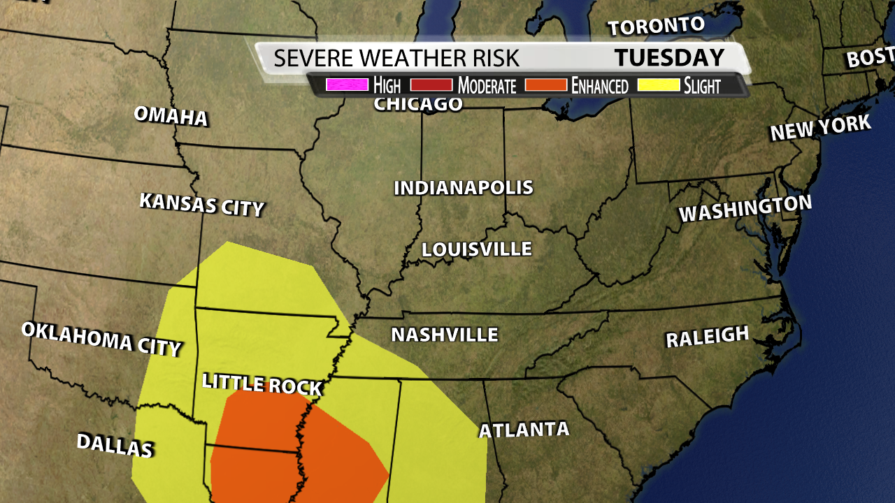
SPC Day 3 Severe graphic made in WDRB's WSI graphics system
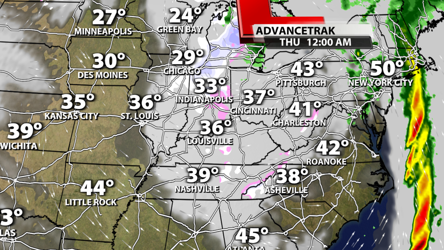
Once the system blows by, winds will decrease some on Wednesday, and cold air will be driven into the region. With any moisture wrapping around the system, we will likely see some snow return to the area Wednesday night and possibly Thursday morning.

AdvanceTrak made in WDRB's WSI graphics system


