

Nobody wants to hear that it's going to rain on Thunder, especially if there is a severe weather threat that accompanies it. But that's exactly what we have in store this year. Let's dig into the timeline, talk about how much could fall, and discuss the severe weather potential.

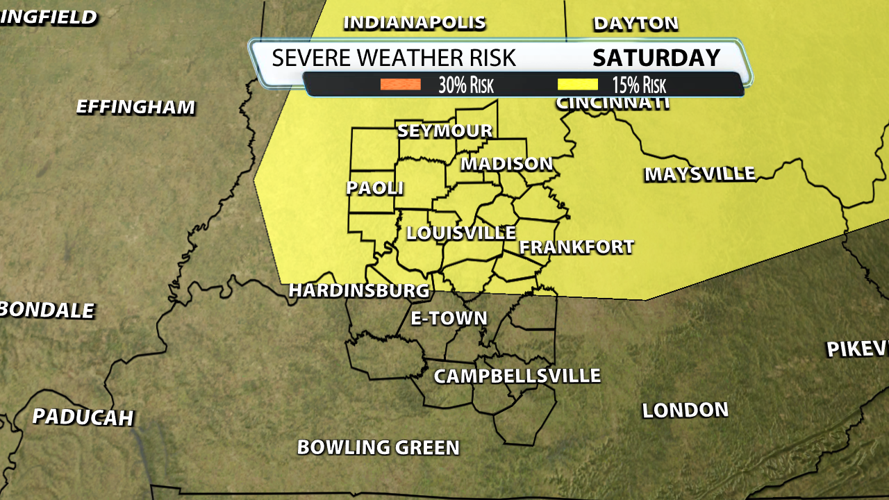
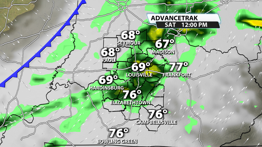
Showers and storms should roll across our region during the morning and early afternoon hours. This initial round will bring the best chance for severe weather potential in the form of gusty winds around 60 mph.

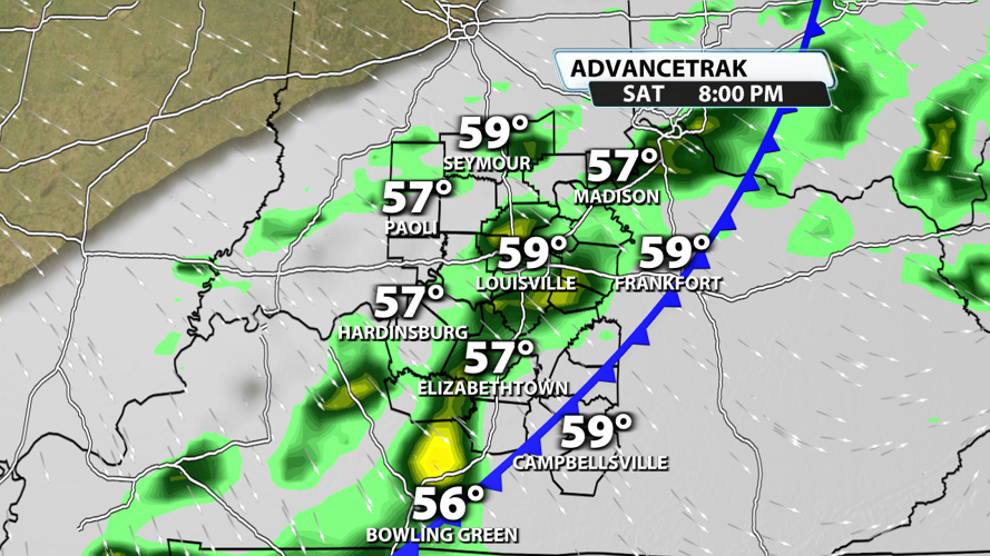
The rain will probably persist for much of the afternoon and evening with some breaks here and there. The cold front likely arrives during the evening hours. This will cut off our severe weather potential and leave us with what will likely be plain rain heading into the fireworks show. Temperatures will probably be in the 50s for the later evening activities.

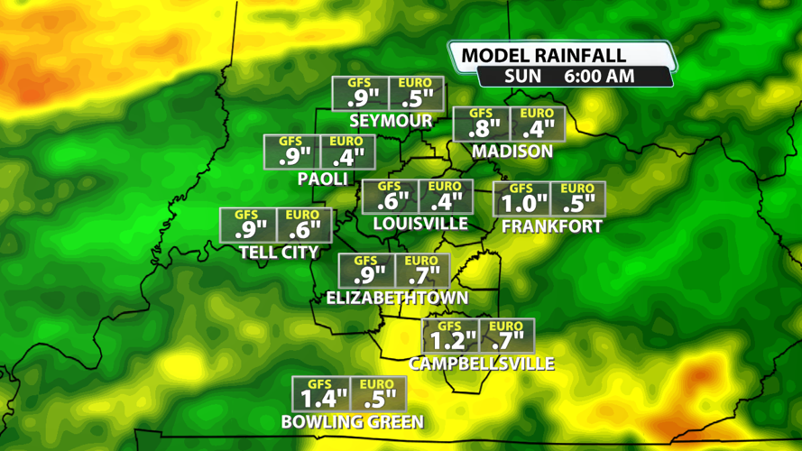
Rainfall amounts will vary from one spot to the next, but .5" to 1" is a fair generalization for many across Kentuckiana. At times, periods of moderate to heavy rainfall rates are expected.

The severe weather threat, as mentioned before, will primarily be damaging winds in the northern half of the viewing area during the morning to early afternoon.

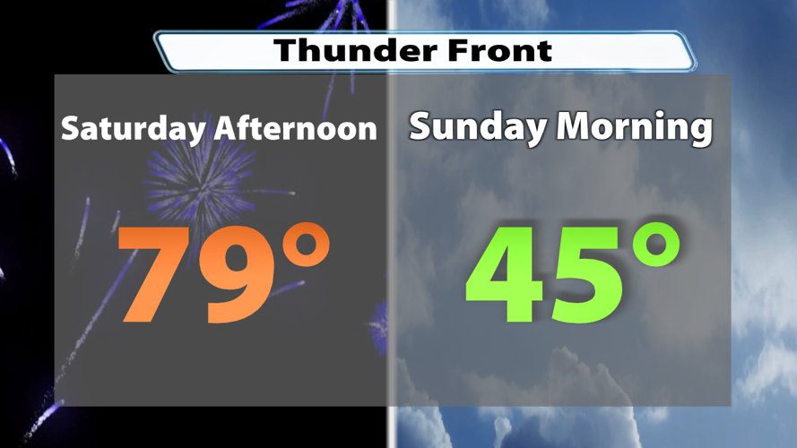
Temperatures will tumble hard on the backside of the cold front. Highs on Saturday will be close to 80 degrees in some spots, while lows Sunday morning will dip into the low to middle 40s. Frost might even be possible early next week!


