A cold front rolled through our area overnight bringing rain to our communities and now a drop in temperature.
The radar estimates most of you saw at least a quarter inch of rain from the showers Tuesday evening. The image below shows those estimates, not how much was measured.
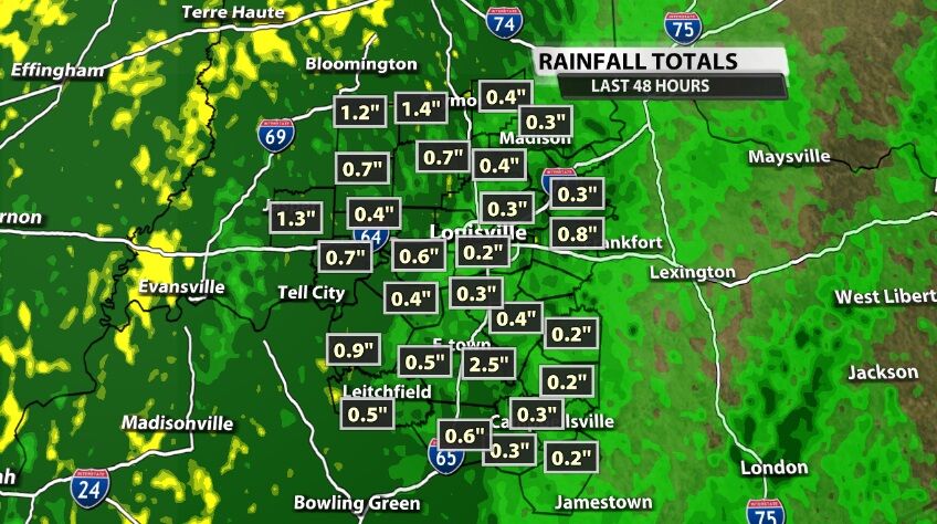
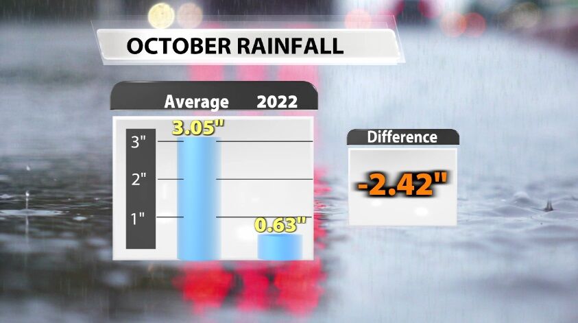
Louisville picked up just over half an inch of rain bringing the monthly total up to 0.63". While that is better than before, it's still not enough. At this point in the month, we average close to three inches of rain.
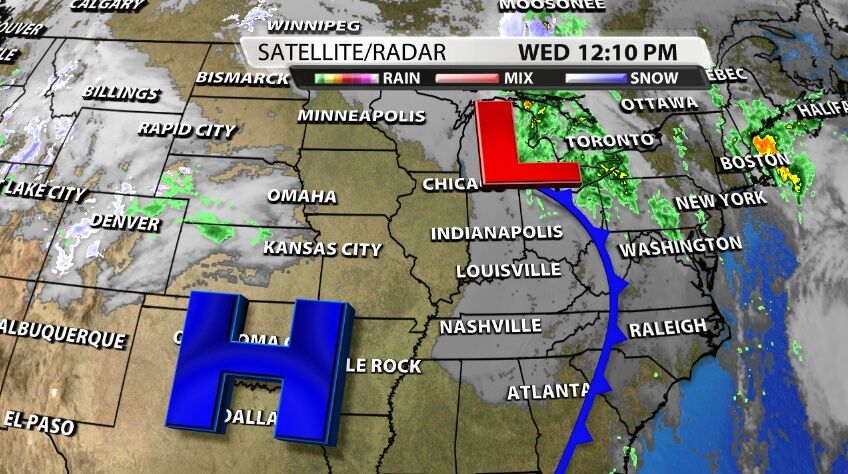
Now we feel the second punch in the one-two from this cold front: the colder air. A cold front separates two different kinds of air - warmer from cooler. We certainly felt the warmer air earlier this week, so now the cooler air on the other side of the front is flowing into our area.
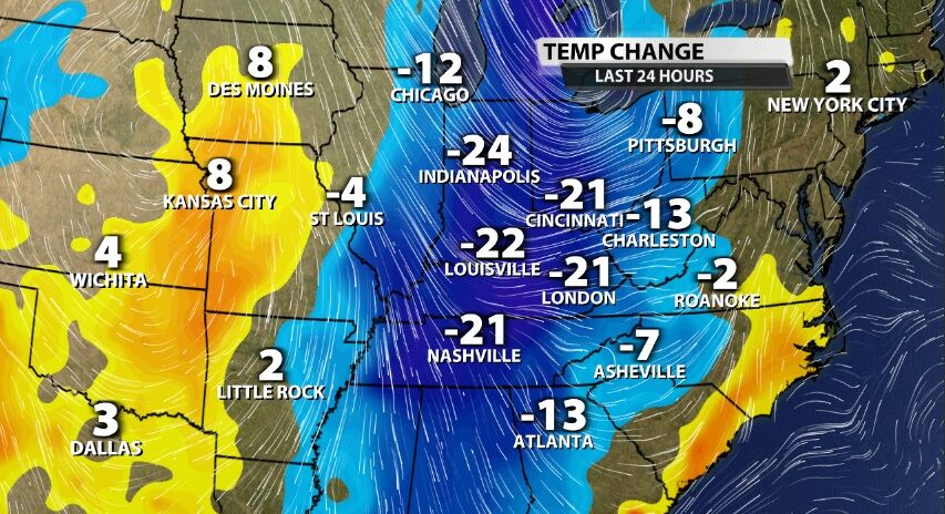
We will be back to low temperatures in the 30s and 40s in the mornings for the next few days with high temperatures in the 60s. While this does feel very different from the weather earlier in the week, this is closer to where we should be this time of year.
Turn on WDRB News tonight starting at 10 to see the latest data on how long this cold air hangs around. Meteorologist Rick DeLuca will have that update plus a look ahead at the next rain chance for our area.


