There are several common mistakes this time of year that can lead to a house fire.
There are several common mistakes this time of year that can lead to a house fire.
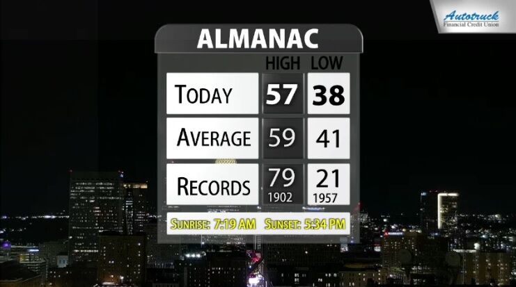
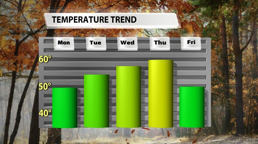
After a nice warm up Wednesday, a cold front will knock your temperatures back down. Wednesday saw both high and low temperatures slightly above climatological normals for our area at this time of year.
Next week brings extended above-average temperatures, but this post is going to give some perspective on what those temperatures will look like. It may not be what you're expecting.
Buckle up! We are hopping back on the temperature roller coaster this week. Sunday afternoon high temperatures only climbed into the middle and upper 30s which is about 15-20 degrees colder than we should be this time of year.
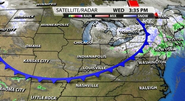
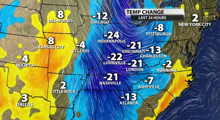
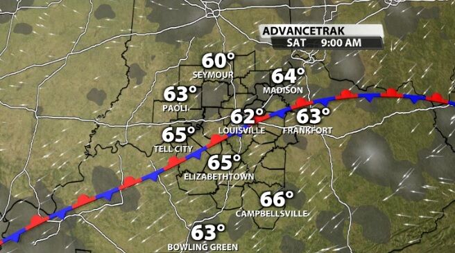
A cold front rolled through our area overnight bringing rain to our communities and now a drop in temperature.
Another cold front will roll through our area Sunday, bringing isolated showers and a widespread temperature drop.
The weather felt SO NICE today! This has a few of you asking, "could this mean an early start to Fall?" Not so fast, my friends. Let's look at what this cool down means.
Even though we are expecting some communities to see highs in the 90s again Thursday, that is our "break in the heat" for this week. Heat surges again Friday and we are likely to feel some of the hottest days of the year this weekend. This post will focus on an early heads up for that increased heat.
It's been another steamy, sticky day across Kentuckiana. High temperatures climbed into the low 90s in many of our communities, but relief is on the way.
Hang on! Our temperatures jump back on the seasonal roller coaster this week. Our temperatures climbed a bit on Saturday thanks to go a good breeze from the southwest bringing in warmer air.