Next week brings extended above-average temperatures, but this post is going to give some perspective on what those temperatures will look like. It may not be what you're expecting.
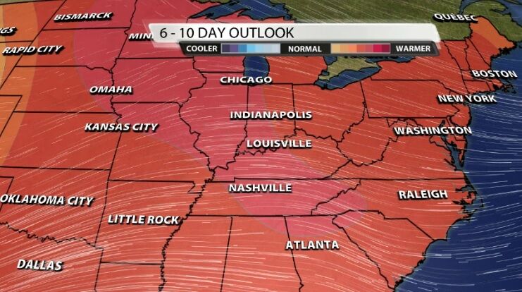
The Climate Prediction Center has placed us in an area of high likelihood to see above average temperatures 6-10 days from now. In fact, high temperatures will be above average most of the week ahead! But seeing so much red on that map might make you expect warmer air than what we will actually see.
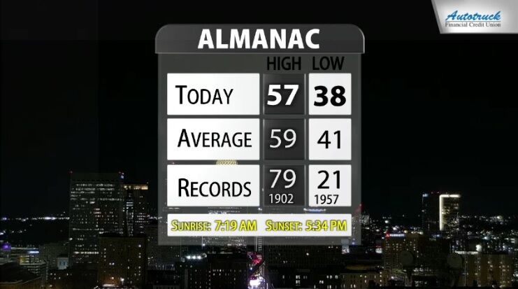
The average high temperature Saturday (based on climatological data from the last 30 years) was 59º. By next Friday (six days from now) that average high drops to 57º and by next Sunday that's down to 56º. The average low temperature Saturday was 41º which drops to 38º by next Sunday, according to data from NWS Louisville.
High temperatures next week should climb into the mid-60s. The first map in this post can sometimes make it look like really warm air is on the way. While mid-60s are above normal high temperatures this time of year, that air won't necessarily feel warm. Low temperatures climb from the high 30s into the low 50s this week, so part of that is below normal and part is above normal. You can click here to take a look at the 7-day forecast.


