

Our area turned into a snowglobe Sunday morning with the winter storm rolling its way on through. It won't be snow all day for most of us, however. Let's dive into when we transition from snow to sleet and then sleet to freezing rain.
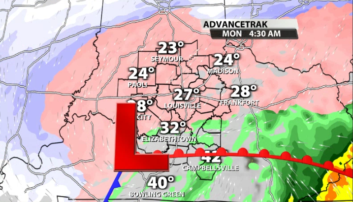
Snow should continue the longest in our Northern counties in Indiana. They are the furthest away from the warm front and warm air advection trying to infiltrate its way into our atmosphere. For Louisville, expect that transition to occur around 12 p.m. to 2 p.m.
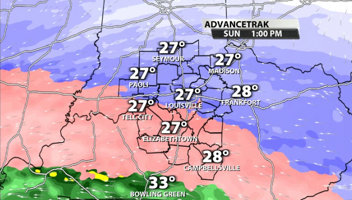
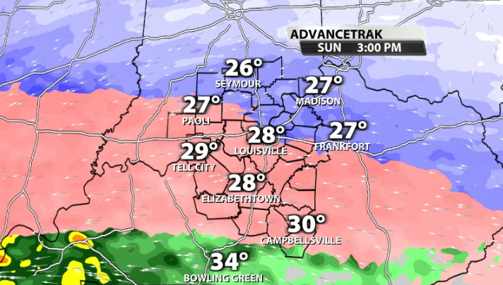
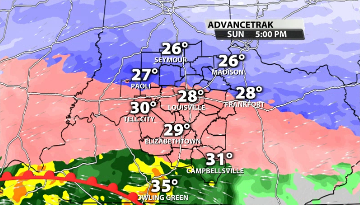
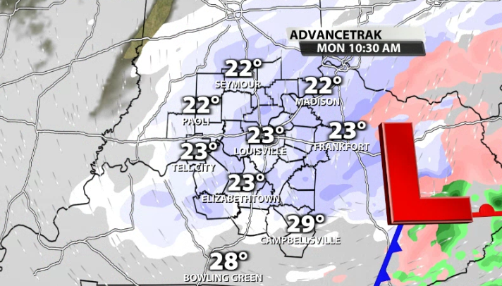
From there, we remain in mostly sleet until near 3 p.m. to 5 p.m when we begin the switch over to a sleet/freezing rain mix and eventually just freezing rain by this evening.
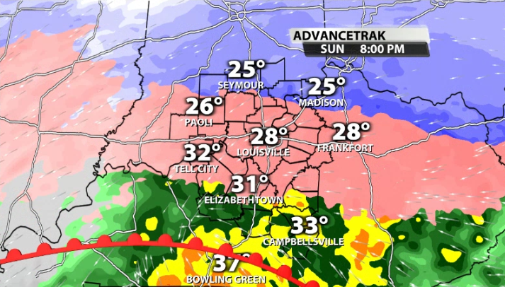
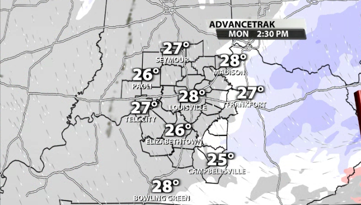
From there it remains a mostly freezing rain scenario into the overnight hours. We will have a dry slot slide its way into our area, which could lighten up the freezing rain. While that sounds good, it's the opposite. Less intense ice falling allows it to accrete easier on powerlines, trees, etc.
By Monday morning near daybreak or soon after, we start to transition from sleet back to more light to moderate snow on the backside of the low pressure. This will be a little added onto anything that fell and froze overnight.
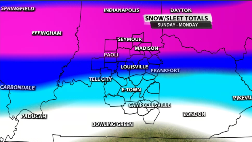
Snow totals have shifted a little, but not a ton. The pink shading for our northern counties in Indiana that includes locations like Seymour, Bedford, & North Vernon can still expect 8-12"+ of snow. The darker blue that includes the rest of southern Indiana and part of Louisville represents 4"-8". The light blue that includes some of our central Kentucky counties like E-Town stands for 2-6". The white shading for our far southern Kentucky communities stands for 0-2".
In terms of ice accumulation, we haven't really seen to many changes as of yet. A lot of what falls will be very heavy and will have trouble accumulating at first, but we should see more stick later in the evening and overnight. In this map, the light pink shading stands for up to 0.1" of ice, the dark purple stands for 0.1-0.3", and the red stands for 0.3-0.6" of ice.

Be sure to be careful out on the roads if you have to travel today. Marc Weinberg and Matthew Wine will be in Sunday afternoon and continue to update conditions and the forecast for the rest of the storm.


