Normally in the winter you read a lot online about the polar vortex or hear people talk about the fact that it's headed your way. That seems to be largely missing so far this winter, so let's talk about why.
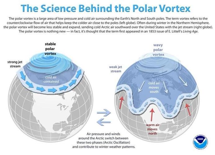
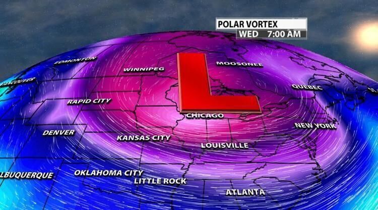
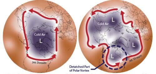
First let's clear a few things up about the polar vortex. It is an area of low pressure—a wide expanse of swirling cold air—that is parked over the north pole. Its not a new thing—this low-pressure system is almost always up there. Sometimes it strays a little bit too far from home. Part of it can break off and migrate southward, bringing some of that arctic air with it. It doesn't "hit us," but sometimes a displacement of the polar vortex from it's normal position does bring us colder air. The image below is an example of that displacement happening last winter.
It ALWAYS exists near the poles, but weakens in summer and strengthens in winter. The term "vortex" refers to the counter-clockwise flow of air that helps keep the colder air near the Poles. Many times during winter in the northern hemisphere, the polar vortex will expand, sending cold air southward with the jet stream. This occurs fairly regularly during wintertime and is often associated with large outbreaks of Arctic air in the United States.

The breaking off of part of the vortex is what defines a polar vortex event here, but it actually occurs when the vortex is weaker not stronger. That might sound weird—but it actually makes sense. Normally, when the vortex is strong and healthy, it helps keep a current of air known as the jet stream traveling around the globe in a pretty circular path (like the image above on the left). This current keeps the cold air up north and the warm air down south. Without that strong low-pressure system, the jet stream doesn’t have much to keep it in line so it becomes wavy and meandering. Put a couple of areas of high-pressure in its way, and all of a sudden you have a river of cold air being pushed down south.
What the Polar Vortex is not:
- a storm system here at the ground
- coming for you or going to hit your house
- a scary, spinning monster
Keep in mind, the polar vortex doesn't come down here to the ground. The PV wind pattern influences the jet stream just a little lower in the atmosphere which drives our weather patterns here at the surface. When that happens we talk about a "displacement" of the polar vortex affecting your forecast. This is not confined to the United States. Portions of Europe and Asia also experience cold surges connected to the polar vortex. By itself, the only danger to humans is the magnitude of how cold temperatures will get when the polar vortex expands, sending Arctic air southward into areas that are not typically that cold. In short, there is no cause to be alarmed when you hear about the polar vortex, but you should be prepared for colder temperatures. When we see pieces break off from the PV, it doesn't necessarily mean either warmer or colder air for us. If one of those pieces becomes displaced near us, that would bring colder air. But if it settles in over the Pacific Northwest, that would mean warmer air for us.


