
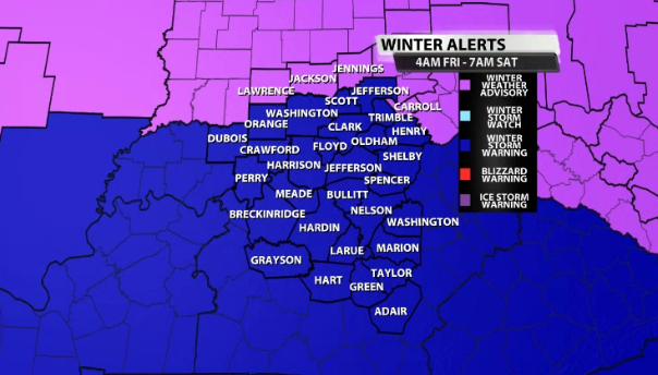
We now have our second Winter Storm Warning of the week! Snow lovers out there must be in heaven with word that fresh powder is on the way. This storm isn't like the last one. Not even close. There won't be any freezing rain or sleet meaning it's an all snow scenario. That should make shoveling much easier on your back.
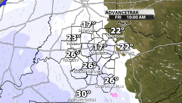
Since this storm will be hitting on Friday, timing is critical. Snow begins around 10 AM give or take a little. With plenty of salt on the primary roads and temperatures near 30, the roads should hold up for a couple hours since the snow will be light. Secondary roads will do downhill quick, not to mention most still have a thick layer of ice on them from the previous storm. Be aware of the ice that lies beneath!
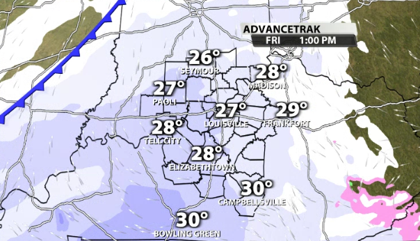
If you hate driving in the snow, be home before 1 PM because the intensity quickly picks up. At this point, roads will be slick and visibilities drop as widespread moderate snow continues.
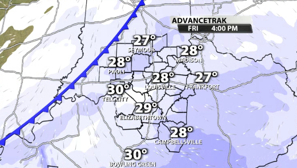
Roads just get worse and worse with each passing hour. Snow is still falling at 4 PM with varying intensity. Obviously, the evening commute looks very hazardous so please alter plans to avoid being out unless necessary.
On a side note, the snow is going to be much better for making snowballs and snowmen since we are looking at a 13:1 snow ratio. The percentage of water to snow is called the "snow ratio" where typically 1" of liquid equals 10" of snow. Those ratios were much higher on Sunday and that's why the snow was very fluffy before the ice.
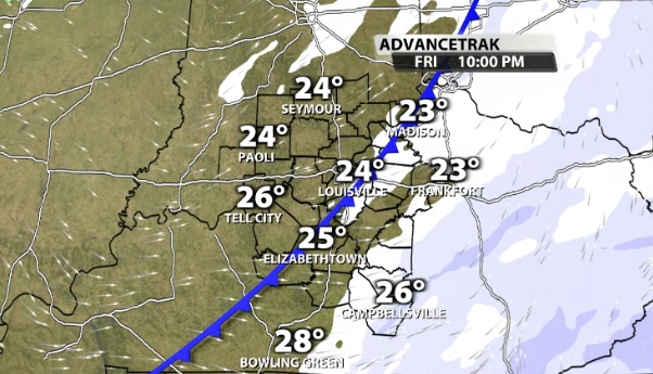
At 10 PM the snow lightens up as a cold front swings by leaving behind flurries overnight into Saturday morning. How much? A range of 3 - 5" of snow will cover the entire area. There may be a narrow band in Southern Indiana that gets closer to 6" as the jet stream enhances snow production there. As always, the WDRB Weather Team will have updates so please check back with us as often as you can. Be careful out there Friday!


