
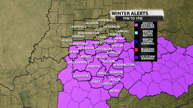
The National Weather Service in Louisville has extended the previous Winter Weather Advisory for our area to include more counties in our viewing area, including the Louisville area.
Here is the text issued by the National Weather Service office in Louisville with this Advisory:
...WINTER WEATHER ADVISORY IN EFFECT FROM 7 PM EST /6 PM CST/
THIS EVENING TO 1 PM EST /NOON CST/ TUESDAY...

* WHAT...Mixed precipitation expected. Total snow and sleet
  accumulations of up to one inch and ice accumulations of up to
  one tenth of an inch.

* WHERE...Portions of and south central Indiana and central
  Kentucky.

* WHEN...From 7 PM EST /6 PM CST/ this evening to 1 PM EST /noon
  CST/ Tuesday.

* IMPACTS...Plan on slippery road conditions. The hazardous
  conditions could impact the morning commute.

PRECAUTIONARY/PREPAREDNESS ACTIONS...

Slow down and use caution while traveling.
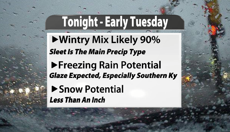
We will have another blog that will come out later today that will dive into the nitty gritty details on what locations should expect specific types of wintry precipitation, so stay tuned for that as we continue to go through this complex forecast.


