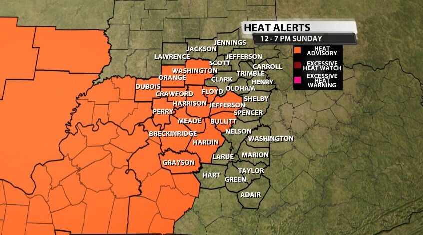
A new Heat Advisory has been issued from Noon til 7 PM (Eastern) Sunday for areas highlighted below in orange. A Heat Advisory means the temperature and humidity will be high enough as to be hazardous to your health.
From
To

Even though we are expecting some communities to see highs in the 90s again Thursday, that is our "break in the heat" for this week. Heat surges again Friday and we are likely to feel some of the hottest days of the year this weekend. This post will focus on an early heads up for that increased heat.

The National Weather Service issued a NEW Heat Advisory for Thursday as the heat index again climbs above 100º.

The National Weather Service office in Louisville has issued a Heat Advisory for most of our communities. The Advisory is valid from Noon until 9 PM Eastern time Monday when the heat index values will be the highest.

A Heat Advisory has been issued for Sunday that includes Carroll, Jackson, Jennings, and Lawrence counties through the hottest part of the afternoon.