

Before you head to bed, let's take a quick look at what's coming for the work week. It will be much more active than the weekend has been and will be on Sunday.
We'll have multiple chances for showers and storms coming up this week, due to two low pressure systems off the west coast. One near Los Angeles that will arrive on Tuesday and another, stronger one south of Alaska that will arrive Thursday and Friday.

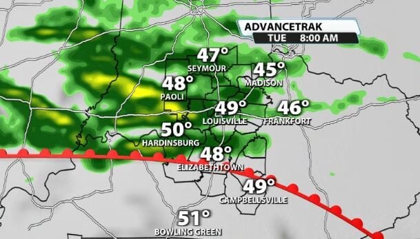
We'll start to see some showers get into our area as early as Monday night, but you'll mainly notice the first chance on Tuesday when scattered showers and possibly some storms roll through our area throughout the day.
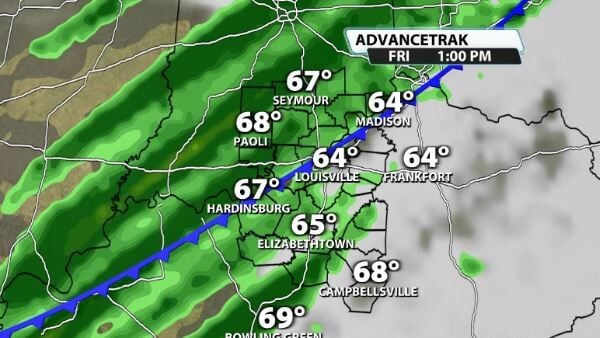
The next one arrives Thursday into Friday. We'll see some rain and storms on Thursday as we get into the warm sector of our next storm system which will bring in more rain and storms by Friday morning/afternoon. This system will have a lot of wind energy with it, so it is important to watch the timing of the storms as they roll in to see if they could use any warmth to become strong to severe.
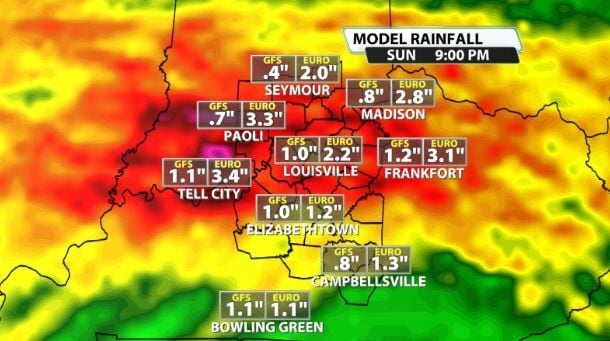
When all said and done, parts of our area could end up seeing 2-3" of rain with locally higher amounts.


