
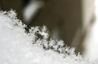
Some of us saw quick hitting snow showers and snow bursts this morning that put down a quick coating on some roads and grass.
Things are escalating quickly in Buckner. Glad I got the dog out when I did ❄️ @BryceJonesWx @JudeRedfield pic.twitter.com/ubFq3RO8oD
— Steve Unger (@DabblingAngler) January 11, 2026
Snow is coming DOWN in Simpsonville right now. Be weary of reduced visibilities in these lines! pic.twitter.com/R8fnEH0C0q
— Bryce Jones (@BryceJonesWx) January 11, 2026
It wasn't much, but if you're a snow lover, there's still a few chances coming up this week. Keep in mind, none of these are set in stone and will change, but they are worth watching.
Other than this morning, Wednesday night and into Thursday morning could bring some snow showers to our area. A front moving through brings what starts as rain on Wednesday as we hang out in the low 40s, but temperatures crash quickly during the evening.
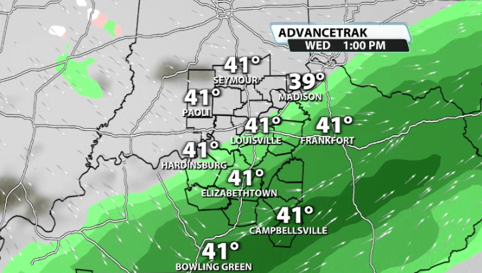
That will eventually bring in a chance for some mix showers by Wednesday night that could switch over to some snow showers by Thursday morning.
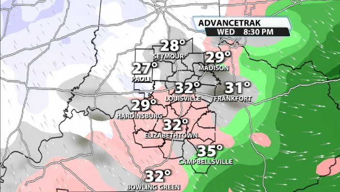

Again, we'd have to have enough moisture left over by Thursday morning for whatever that's left to switch over to snow, so confidence isn't high on this yet, but it's worth watching.
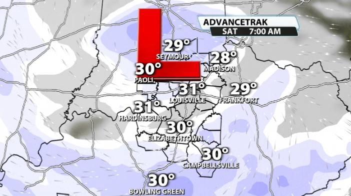
The second chance could come next weekend. Obviously, we're still almost a week away from this one, but some model data is focusing on Saturday of next weekend as a low pressure that has access to the cold air already in place slides by. Snow (if any) totals would depend on the track of the low, which is nowhere near set in stone yet. Still, that is another one we will watch heading through the week.


