


It's a tale of two types of weather this weekend as we transition from a fairly calm and extremely pleasant Saturday to a much windy and eventually stormy Sunday. Severe weather is looking increasingly likely Sunday evening and overnight. Let's dig into the details.

To start, we'll have a Wind Advisory for all of our Kentuckiana counties from 11 AM Sunday to 8 AM Monday. This is a very long time period for this type of advisory. Winds (absent the storms) will probably be at their strongest Sunday afternoon and early evening with some gusts around 45 mph. After the storms roll through, winds will still be gusting around 30 mph heading into Monday morning.

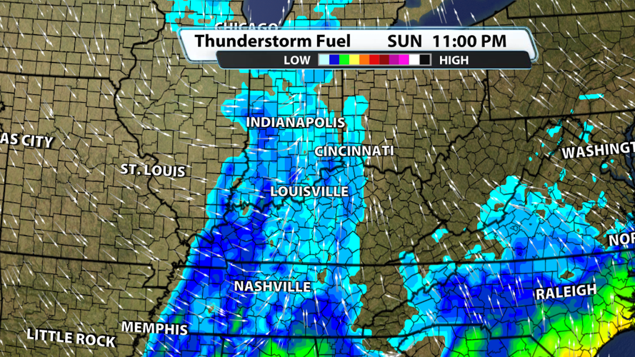
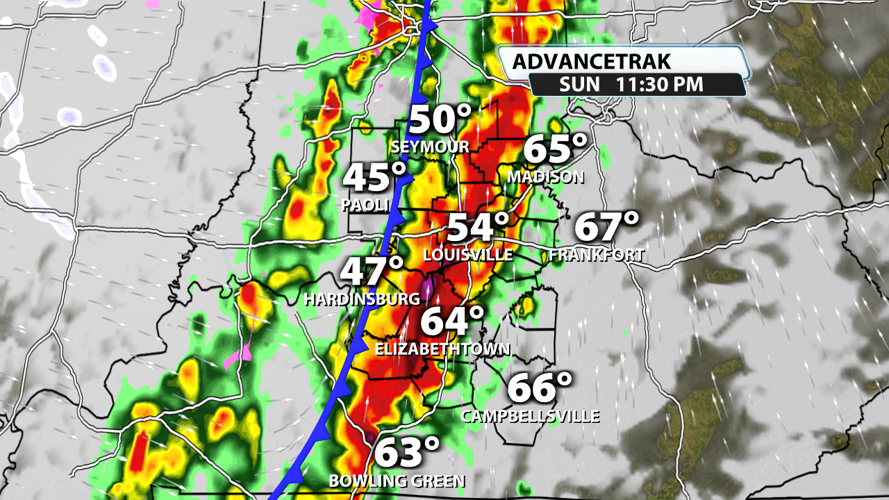
The storms will probably move into our western counties after most folks have wrapped up eating dinner. As of now, a start time of 8-10 p.m. for our western counties is fairly likely. Storms could speed up or slow down, so keep tuning in for updates over the next 24 hours. The storms will probably be at their strongest as they approach our region and start to weaken while moving across the viewing area.

Louisville will probably see storms arrive between 10 PM and 12 AM. They will still be capable of producing 60+ mph winds and tornadoes.

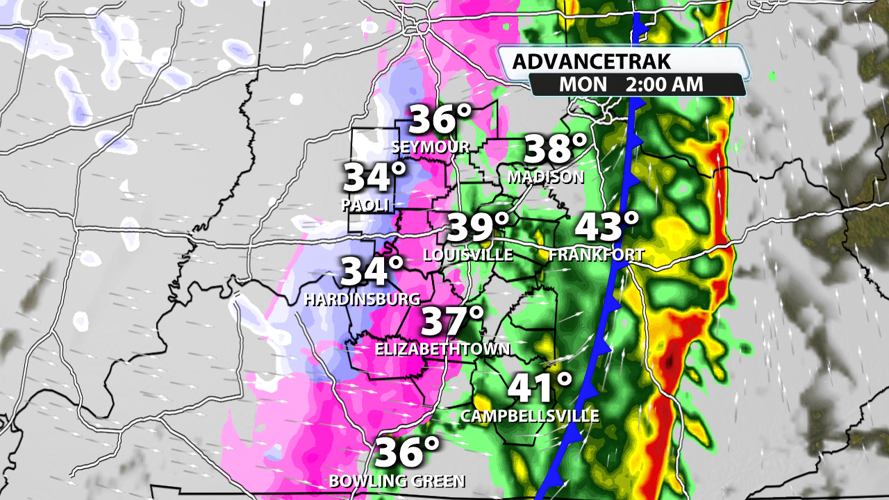
Storms should exit the eastern side of our viewing area around 1-3 AM. Behind the storms, cold air will rush in, and we could see a brief transition to snow; however, this model is quite bullish compared to others in regards to the intensity of snowfall. Some elevated surfaces could end up being covered by a layer of snow late Sunday night or throughout the day Monday.

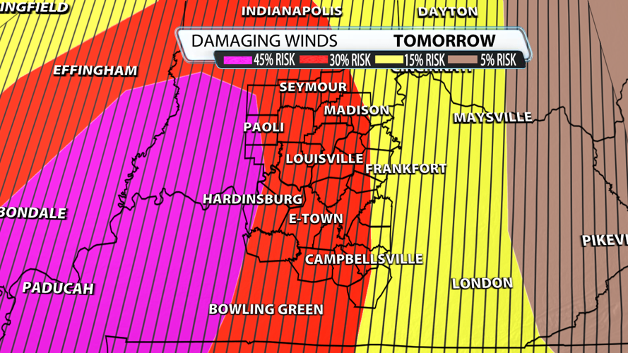
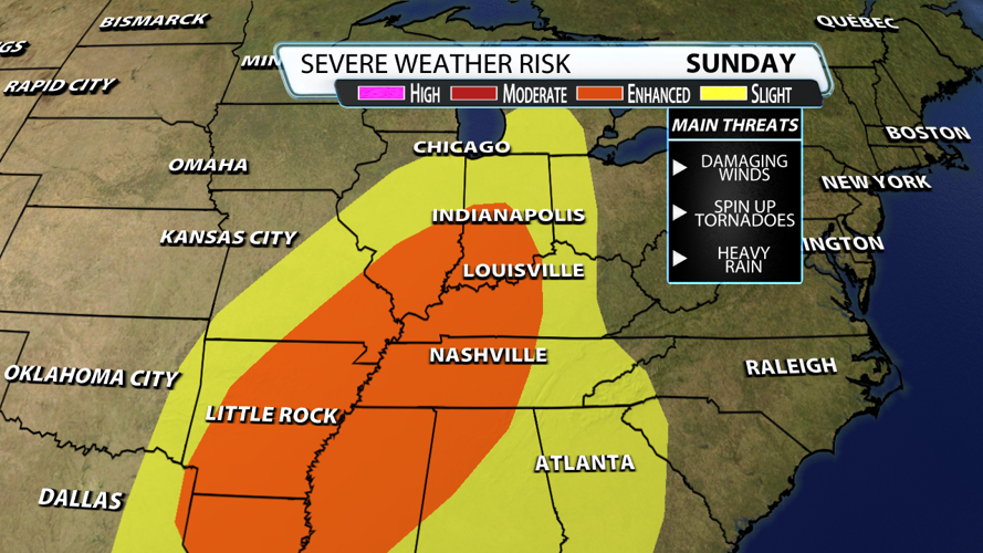
The Storm Prediction Center has put most of Kentuckiana under an Enhanced Risk (3/5) for severe weather. Damaging winds and a few tornadoes (or less) with very heavy rain is the most likely scenario.

We are very confident that wind gusts of 60-70 mph are likely for many places based on the very fast winds of 70-80 mph at 850mb. You can see the data pointing to hurricane force wind speeds at 850mb (roughly one mile off the ground) as the storms are moving through our region. Not only are winds moving faster at 850mb than at the surface (speed shear), but there is just enough turning of the winds (directional shear) as you go up from the ground to higher in the atmosphere that tornadoes embedded in the line of storms will be possible.

Surface-based energy is fairly limited with this storm setup. And that's a good thing! If there were a lot of storm energy and these really fast moving winds, then we would expect storms to be even more intense and produce stronger and longer lived tornadoes. In tomorrow's case, tornadoes should tend to be shorter-lived and on the weaker side.

As mentioned before, damaging winds are the biggest threat to life and property. We will probably receive numerous reports of trees and powerlines down tomorrow evening and overnight. Be extra careful if you are driving at night or early Monday morning. Trees and lines across roadways will make travel hazardous, particularly when you can't see far ahead of you at night.

The higher tornado threat comes right up to Grayson County, but most of our region is under a 5% risk for a weak tornado. Severe criteria hail is fairly unlikely with this setup, but some smaller hail is definitely possible.

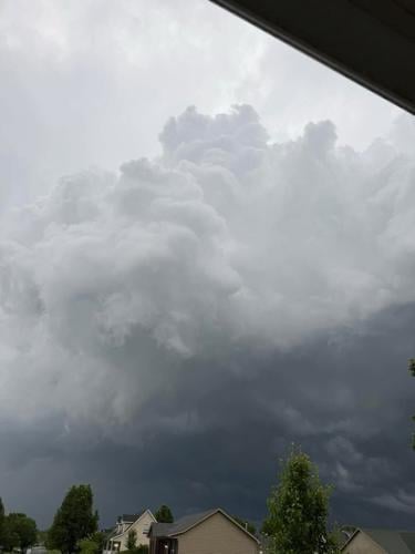
This viewer photo shows storm clouds in Shepherdsville, Kentucky as sever weather moves through the area on Friday, May 16, 2025.


