

Rain started early this morning and it likely won't stop through the rest of the day and even through early tomorrow morning. This will likely cause many areas of flash flooding and in some cases, life-threatening flash flooding for part of our area. Let's dive into how much is going to fall and where the flash flood concern is largest...
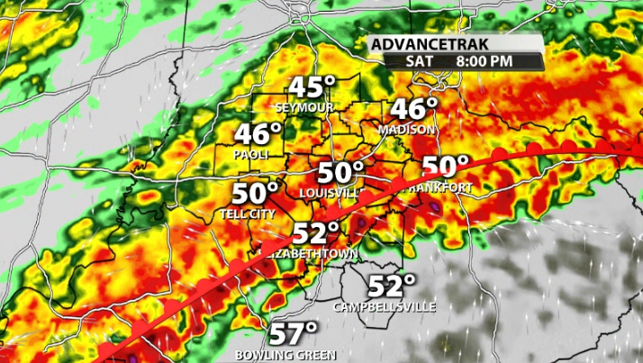
The rest of the day will be wet. No question. Rain is expected to ramp up and become heavier and remain widespread through the afternoon as a warm front pushes its way further north.
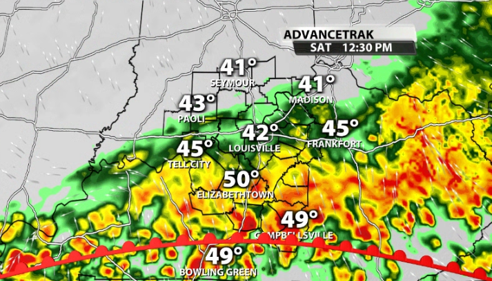
Where this warm front ends up this afternoon, is likely where the heaviest rain will fall, and be a placemaker for where strong to severe storms could be possible tonight.
That warm front sets up just south of Louisville in data by this afternoon, with widespread heavy to torrential rainfall continuing to fall.
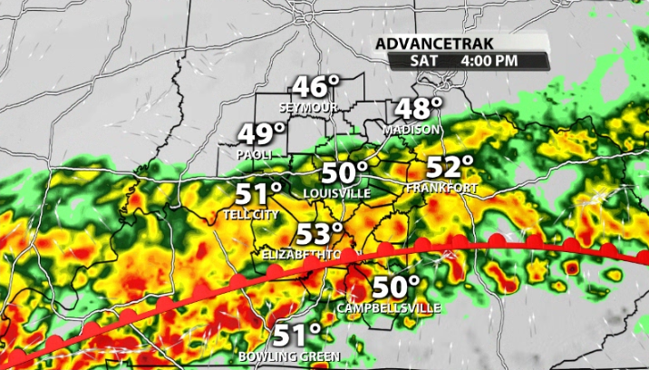
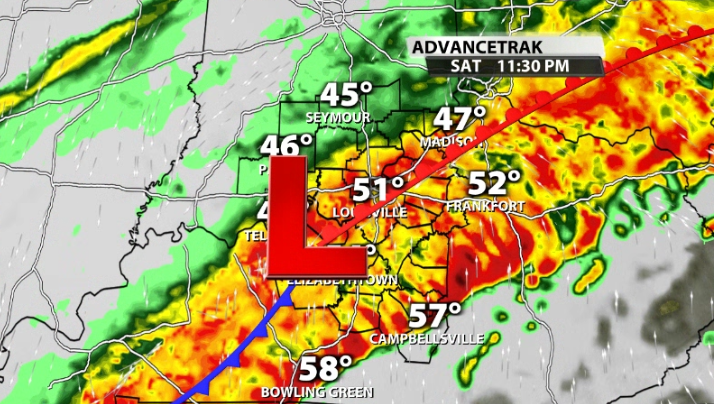
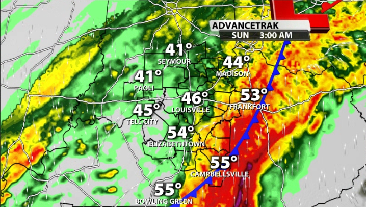
By tonight, storms ramp up along and south of the warm front where there is some storm energy available. The threat for severe weather is low, but by no means zero. We can't rule out some damaging winds or a brief spin up late tonight.
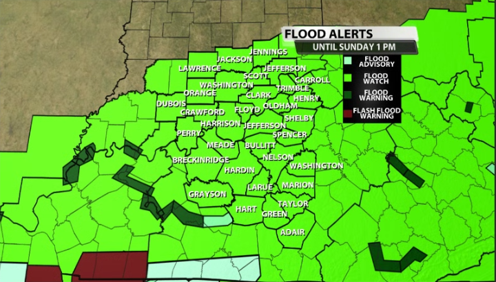
Flood Risk
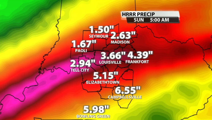
While we need to keep an eye out for strong storms tonight, the biggest threat is flash flooding. Widespread 2-4" of rain look likely, but there could be some localized areas that could see 4-6" of rain, which could cause dangerous and life-threatening flash flooding.
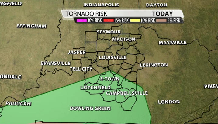
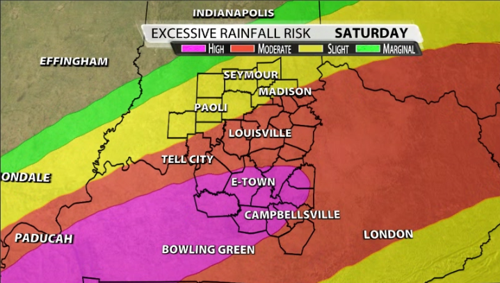
The Weather Prediction Center has part of our area under a very rare high risk for excessive rainfall that includes areas like E-Town, Leitchfield, Bardstown, and Munfordville. Louisville is still included in the moderate risk and flash flooding should still be considered a large concern in the metro.
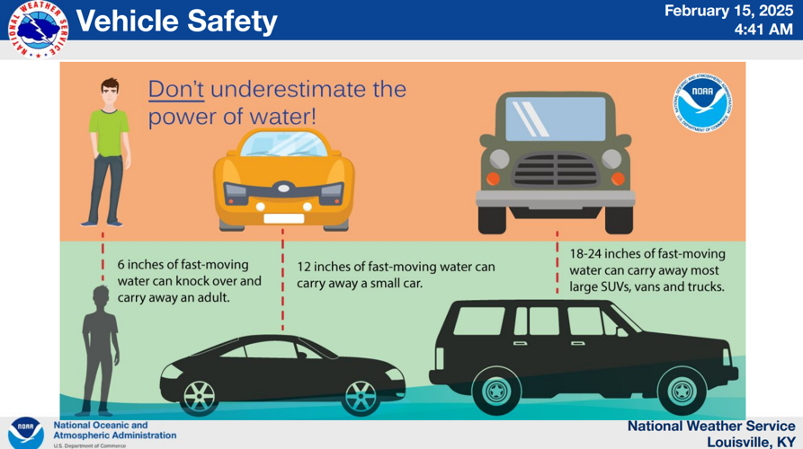
Please avoid all flooded roadways and remember the phrase, "turn around, don't drown." It doesn't take much water to lift your car. Areas that are prone to flooding will see flooding issues by tonight/tomorrow morning and in addition we need to watch out for river and creek flooding.

Image: NWS


