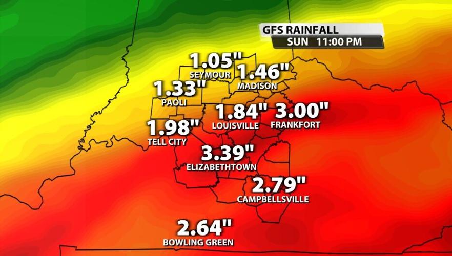
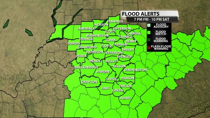
The National Weather Service has issued a Flood Watch for all of our area Friday evening through Saturday night. Across our area 1"-4" of rain is likely by the end of the day Saturday with a few spots seeing even more than that. The axis of heaviest rain cuts right through our communities, and the heaviest rain starts overnight.

We are particularly concerned about people driving or walking through flood waters while it is still dark Saturday morning. Please be careful; never drive or walk through flood waters. As a general rule, if you can't see the paint on the road underneath the water, turn around and find a different way to where you are going.

Below is the text issued by the National Weather Service office in Louisville with this Flood Watch:
FLOOD WATCH IN EFFECT FROM FRIDAY EVENING THROUGH SATURDAY
EVENING...

* WHAT...FLOODING CAUSED BY EXCESSIVE RAINFALL IS POSSIBLE.
  FORECAST RAINFALL AMOUNTS OF 2 TO 4 INCHES WILL BE POSSIBLE FROM
  FRIDAY EVENING THROUGH SATURDAY EVENING.

* WHERE...ALL OF SOUTHERN INDIANA AND CENTRAL KENTUCKY.

* WHEN...FROM FRIDAY EVENING THROUGH SATURDAY EVENING.

* IMPACTS...EXCESSIVE RUNOFF MAY RESULT IN FLOODING OF RIVERS,
  CREEKS, STREAMS, AND OTHER LOW-LYING AND FLOOD-PRONE LOCATIONS.
  FLOODING MAY OCCUR IN POOR DRAINAGE AND URBAN AREAS. LOW-WATER
  CROSSINGS MAY BE FLOODED.


