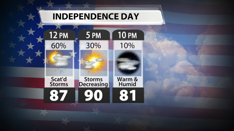


All eyes will be on the skies tomorrow with fireworks shows and storms possible for Independence Day. We'll know more about the timing of the rain with the latest data tomorrow morning, but many models are pointing to a decent amount of dry time during the evening hours.
Showers and storms will be possible throughout the day Thursday, but it won't be raining in your area all day long. The best chance for rain looks to be before 5 PM EDT. After that, rain chances will decrease, but a few showers/storms may lingering into the night. If you are planning outdoor events for the Fourth, have a way to bring people inside quickly in case a storm pops up near you.

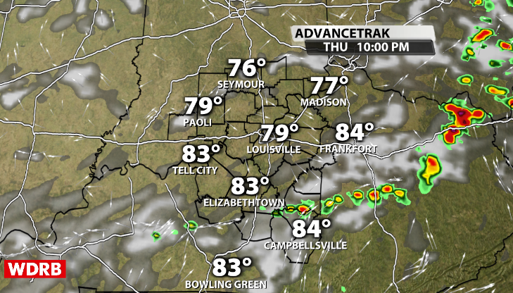
For those shooting off fireworks Thursday night, that 10-20% chance for rain may happen along a boundary laid down by storms earlier in the day and could still produce downpours and lightning. It's impossible to know today exactly where boundary will set up tomorrow, so make sure to check WDRB meteorologists' social media accounts for the latest forecast throughout the evening. Below is an example (not a guarantee) of storms popping up along a boundary after sunset.
If you plan to host your fireworks show Friday night or Saturday night, you'll very likely have plenty of dry time. This weekend looks dry and seasonably warm with middle and upper 80s on Saturday and a touch warmer Sunday.
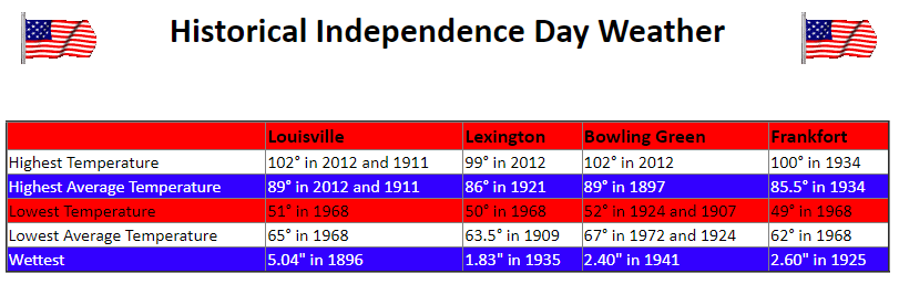
Considering Independence Day falls in the summer, there off are very hot and stormy July 4th celebrations. Below is a chart from the NWS in Louisville of some of the temperature and rainfall extremes recorded across Kentucky.


