

With river levels rising a lot this week, the question comes up, how does this flood compare to what we saw back in 2018? What about other historical flood dates in Louisville?
As of Saturday morning, the Ohio River at Mcalpine Upper (Downtown), is forecasted to crest at 35.5ft on early Wednesday morning.

That is considered moderate flood stage. It would be considered major flood stage beginning at 38 feet. Here's what this could look like if this forecast verifies using the NWS Flood Inundation Map. You can see the waterfront is under water, the river comes up under I-64 downtown, and comes up even through part of the Galt House.

How would this compare to 2018 if that forecast is correct? Well back in 2018, the river crested at 35.72ft. This is eerily close to the current forecast for the crest later this week! Here's what that flooding looked like back in 2018:

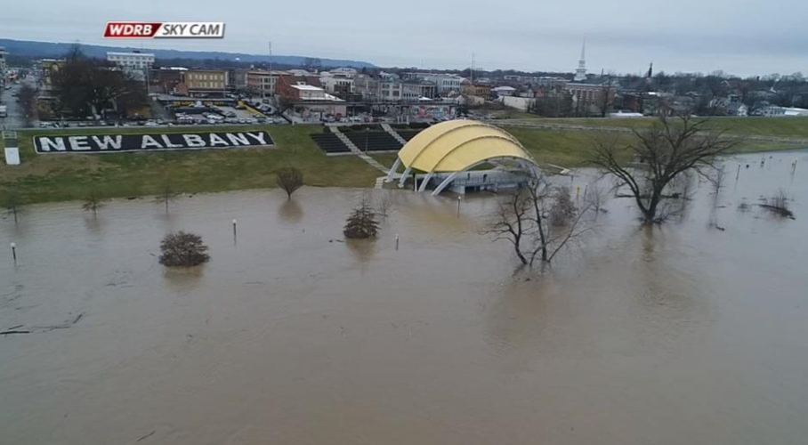
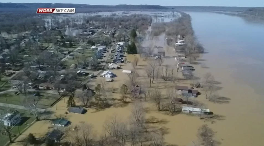
Flooding along the Ohio River in 2018. WDRB Image.

Flooding along the Ohio River in 2018. WDRB Image.

Flooding along the Ohio River in 2018. WDRB Image.
Image: NWS
Now of course, 2018 wasn't the highest crest we've ever seen at Mcalpine Upper. In fact, it is just the 10th highest! Back in 1997 some of you may remember when the river crested at 38.76ft. Of course, the worst was the historic flood of 1937 when the river crested at an astonishing 52.15ft.


