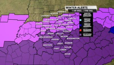
The National Weather Service in Louisville has expanded the ICE STORM WARNING to include more of the viewing area. Meade, Bullitt and Spencer Counties are now also included in this warning. This continues to edge farther north and closer to metro Louisville. The warning remains in effect until 7 pm Thursday.
More information regarding the warning is below.

* WHAT...Significant icing expected. Widespread ice accumulations of a quarter to half inch, with localized amounts up to three quarters of an inch. Isolated higher amounts are possible. The heaviest ice accumulation is expected to occur south of the Western Kentucky and Bluegrass Parkways.
* WHERE...Much of central Kentucky.
* WHEN...Today and tonight near the Western Kentucky and Bluegrass Parkways, expanding into south central Kentucky tonight and Thursday.
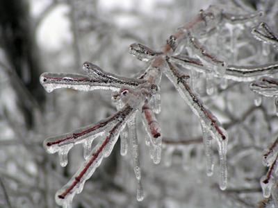
* IMPACTS...Significant power outages and tree damage are expected due to the ice. Travel could be nearly impossible at times.
PRECAUTIONARY/PREPAREDNESS ACTIONS...
Travel is strongly discouraged. If you must travel, keep an extra flashlight, food and water in your vehicle in case of an emergency. Prepare for possible power outages. If you must use a generator for emergency power, make sure that you run the generator outside of your home...not inside your home.


