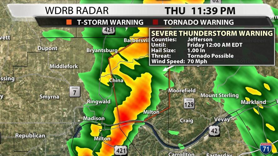
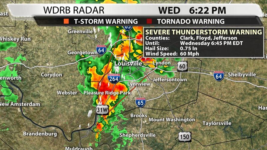
Severe weather warnings are changing, and you have already seen some of these changes this season! Below are two examples of impact-based warnings our WDRB Weather team has posted to social media in the last few weeks. (note: these warnings are NOT CURRENTLY ACTIVE)


You will notice the graphic now shows you the threats that storm is carrying. Hail, wind, and tornadoes are all reasons a storm might get a Severe Thunderstorm Warning, like the ones above. Hail must be (or believed to be) at least 1" in diameter, wind speeds at least 58 mph, or indications that the storm may produce a tornado (like broad or subtle rotation seen on radar).

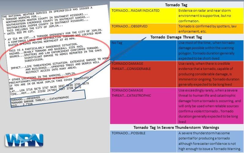
To boil it down, the goal with these impact-based warnings is to help the really bad situations stand out a little more and to better point out the threats each different storm is bringing. We've already seen this done with Tornado and Flash Flood Warnings, so let's explore those first. When you get a Tornado Warning now, these are the options:
- "radar indicated" or "radar observed" - this is the "regular" tornado warning we've had around for a while
- "considerable"
- "catastrophic"
- the image above from the National Weather Service does a great job explaining the differences between each "tag"
Flash Flood Warnings work the same way: basic (no tag), "considerable," and "catastrophic."
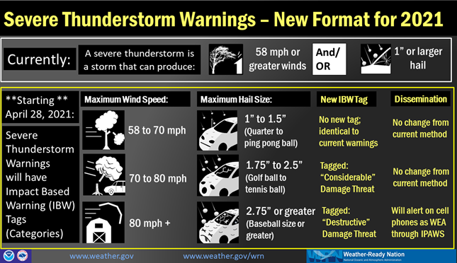
Now Severe Thunderstorm Warnings will work this way, too, with base warnings staying the same; being tagged "considerable" for worse damage or "destructive" for the worst. The image below shows the base warning will be used for hail the size of a quarter to the size of a ping pong ball or if the wind is expected to blow between 58 and 70 mph. This won't be issued any differently than what we were using last year. NWS will use the "considerable" tag when wind gusts are expected to be 70-80 mph and/or hail the size of golf balls to tennis balls. The top level warning will only be used when the wind gusts are expected to be over 80 mph (which is pretty rare around here) or the hail is expected to be baseball size or larger (also rare here). When warnings use this "destructive" tag, they will now be sent automatically to your phone like what already happens with a Tornado Warning and a Flash Flood Emergency.
We in the WDRB Weather center will be the ones seeing this info from the National Weather Service and relaying it to you, so you don't need to try to keep all these different tags straight in your mind. Like the graphics included at the beginning of this post, you will start to see the main threats each storm carries when a warning is issued. This is what we will be posting to social media and sharing on television to hopefully help you make good decisions for you and the people around you when bad weather comes.


