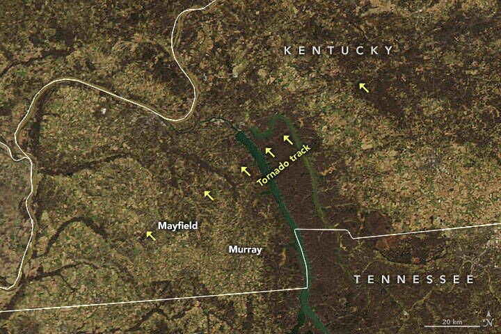
The damage caused by tornadoes across the Commonwealth two weeks ago can be seen from satellites orbiting space. NASA shared the image below showing the long tornado track through western Kentucky seen by the damage the storm did to the landscape.
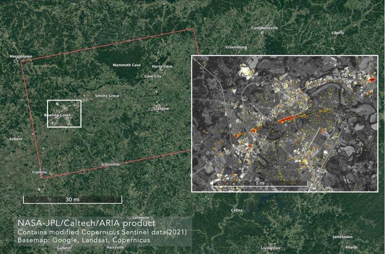
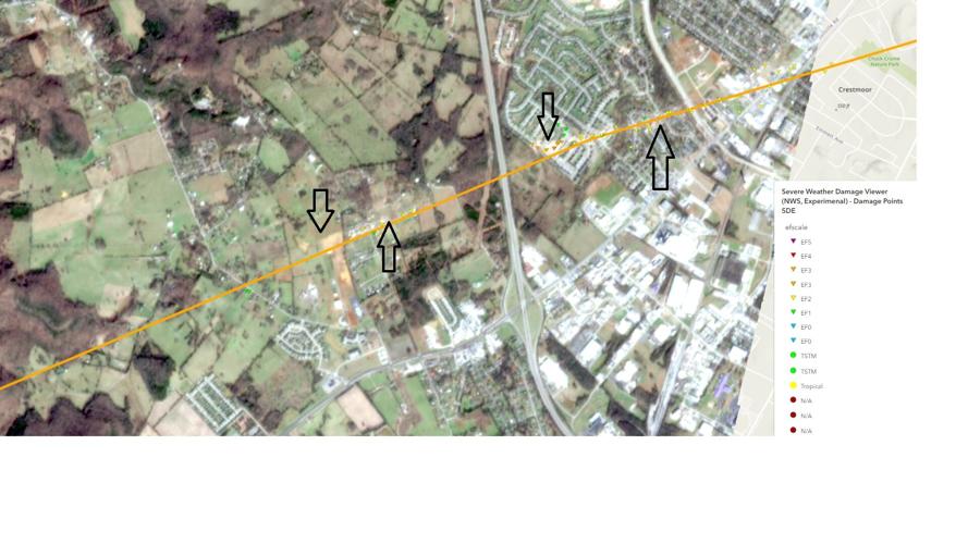
The image below that I pulled from the satellite and added arrows to shows communities southwest of Bowling Green. The orange line shows the tornado track established by the National Weather Service and the triangles mark spots where damage of a specific strength was found. I added the black arrows to point out some of the most visible damage you can see on the satellite image. Keep in mind the satellite that took this photo orbits the Earth in outer space, yet it can see the damage tracks from a tornado in our state.

NASA also has a page for imagery of recent disasters that can make it easy to find images like these.


