
The chance for snow Monday night is raising a lot of question, so we will try to answer those here. A Winter Weather Advisory has been issued for a large part of our area Monday night through Tuesday morning. Click the link below to read more about the Advisory.

A Winter Weather Advisory has been issued for part of our area Monday night through Tuesday morning. This Advisory is highlighting which spots could see accumulating snow in that time frame.
SETUP
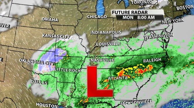
A low pressure center is positioned closer to the Gulf Coast Sunday night and will move toward the north east tonight. As it does it will push rain and thunderstorms toward us by Monday morning.
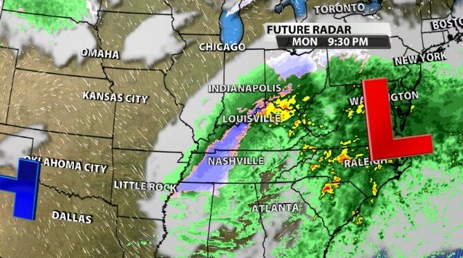
When the low moves away from us later in the day Monday, the atmosphere will cool while that moisture is still present bringing snow potential to part of our area.
TIMING
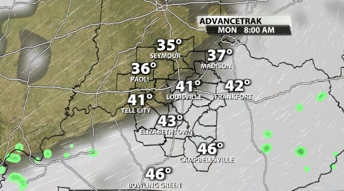
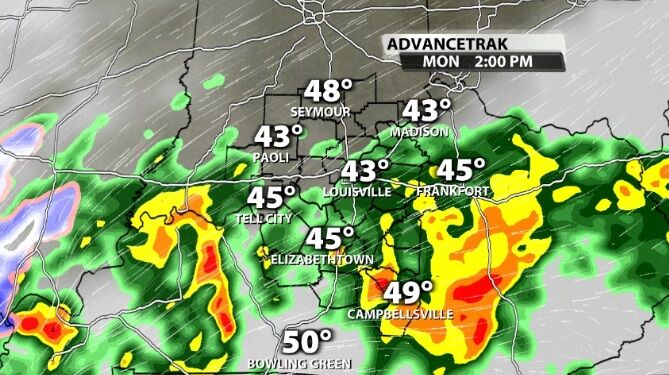
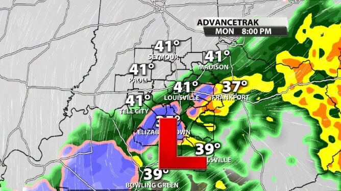
Light sprinkles start our day Monday with heavier rain moving in by early afternoon. Where you see this heavier rain, we could also see scattered thunderstorms. Those would bring thunder and lightning, heavier rain, and gusty wind. Small hail is possible, too, but less likely.
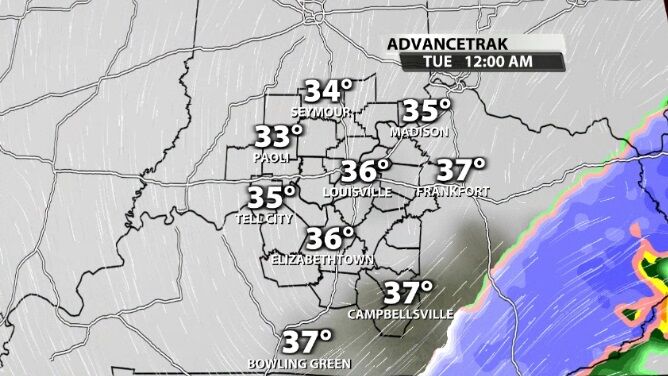
Around sunset, as colder air starts to flow into the atmosphere above our region, a quick transition from rain to snow will start. The snow will be heavy, just like the rain was. This is the problem. Snow rates of 1"-2"/hour (and even heavier) will be possible in this narrow band. That means a lot of snow can fall in a short amount of time, but it will only happen in a small area. Pinpointing that area and how much snow is possible there is the hard part of this forecast.
Also keep in mind as snow falls, it cools the air around it. And heavy snow can overcome ground temperatures above freezing. That means if enough snow is falling, it will start to accumulate even though the air at the surface and the pavement temperatures look too warm to support it. The snow actively cools the surface which will help lower those temperatures and increase how much snow is sticking. That's the only shot we have at good accumulation; heavy snow overcoming the above-freezing surface temperatures. There's a good chance of that happening, so please don't write this off just because Monday's forecast high temperature is in the 40s.
Most of the snow should move east out of our area by midnight between Monday and Tuesday. This means the worst impacts will likely be felt as this transition is starting Monday night and for those of you who have to get out early Tuesday morning.
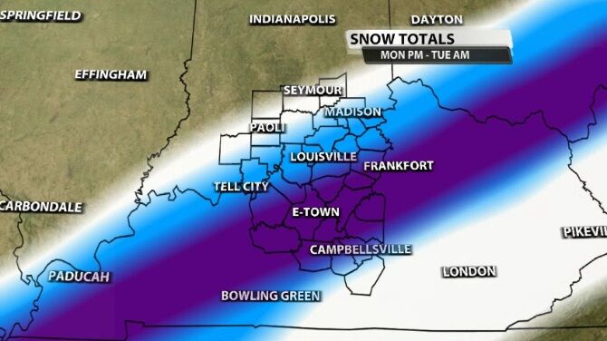
That area of highest snow amounts has been trending farther south most of the day today, so I'm expecting this band to set up south of the Ohio River. The dark purple shading in the image below is where the heaviest snow looks most likely. 3"-6" of snow will be possible here.
The thin lines of white and blue shading represent smaller snow totals (up to one inch and 1"-3", respectively) and demonstrate there will be a sharp cutoff between who can see half a foot of snow and who sees no snow at all.
Tune into WDRB News tonight at 10 to go through the timing of this snow chance hour-by-hour and hear my thoughts about the amount of snow on the way.


