
The snow, sleet, and freezing rain have now blanketed our area. We are in the midst of the second round of winter weather coming from this storm. This post is a "nowcast" - what we are seeing now and how it affects the forecast through the rest of the evening.

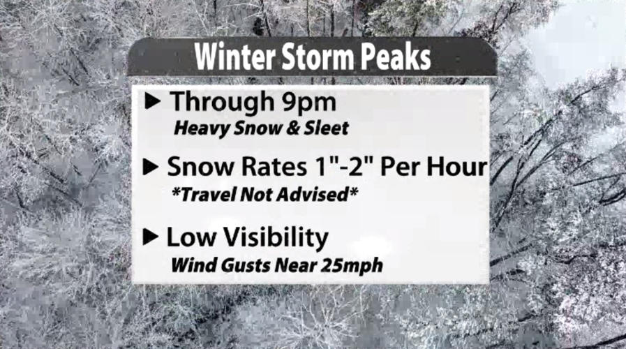
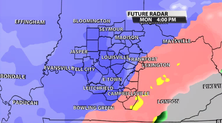
This will be the most impactful part of the storm. We will talk more about the timing below, but through roughly 9 PM we will see rounds of heavy snow and sleet leading to low visibility and potentially dangerous travel conditions.

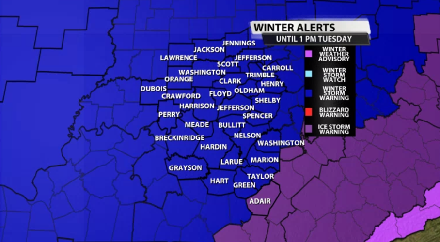
The Winter Storm Warning remains in effect until Tuesday afternoon, and Adair county has been added to the Ice Storm Warning because more accumulating ice from freezing rain is likely there. Ice and snow totals can be found below.

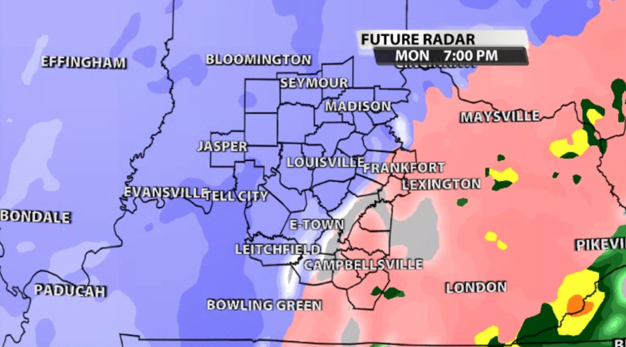
Through the evening as the precipitation cools the column of air, we should see a change over to more snow instead of the majority sleet we are seeing now. That's really when totals will start to stack up.

You will also see the line between snow and freezing rain (the difference between purple and pink) shifts farther south through the evening, too. We also may see some "dry slotting" with the heavier precipitation this evening. That just means small "holes" will open in the otherwise completely filled in precipitation shield like what you see in the image below.

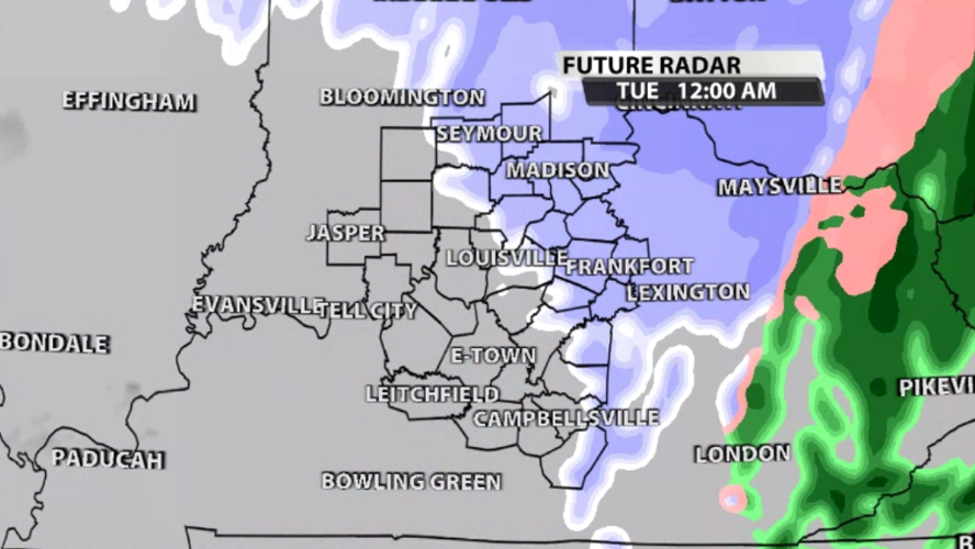
After midnight most of the moisture moves out of our area continuing on its northeasterly track. However temperatures will be dropping into the teens, and we will likely still see snow flurries into the day on Tuesday.

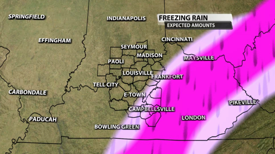
Up to a quarter inch of freezing rain will be possible in the light pink shaded areas in the map below. Outside of the pink shading, ice accumulations should stay below a quarter of an inch. The dark pink shading shows where more ice will accumulate, likely a quarter of an inch to a half inch with some communities seeing more.

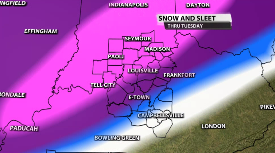
We still expect the highest snow totals in southern Indiana where you will switch to all snow (as opposed to snow and sleet) sooner. There will be great disparity in snow totals between the Ohio River and the Kentucky and BG Parkways. The white shading below represents 1"-3" of snow with small gradients between the pink shading where 8"-12" of snow and sleet accumulation will be possible.

Tune in to WDRB News beginning at 4 PM to hear the latest updates from Marc Weinberg and Rick DeLuca and to get a look at what the sleet and snow is doing to roads across our area from our WDRB reporters.


