
The last several days have been gloomy without the sun, but high temperatures have been pretty close to average for this time of year. That is going to change this week as a more potent weather system rolls through our region.

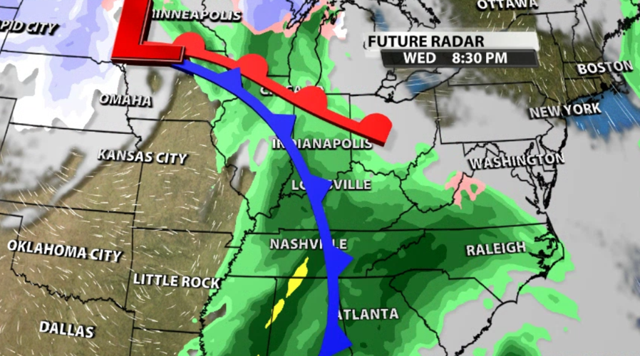
A closed low pressure center will pass north of our area, but the trailing cold front will move right through. This cold front will bring the one-two punch of both rain and cold air, but they don't arrive at the same time. Since this is a "closed low" - meaning it's sort of wrapping in on itself - it will take the coldest air a couple days to get to us. The rain will start late Tuesday.

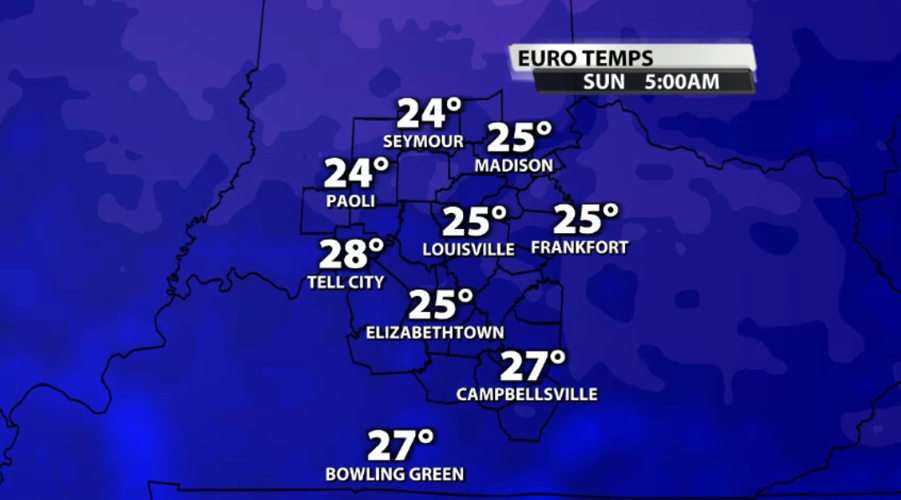
This shot of cold air, when it does hit, will drop low temperatures into the 20s and high temperatures to the 30s. That will feel pretty different after a week of highs in the 50s and lows in the 40s.

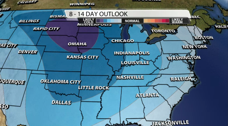
It's not just a cool-down for a couple of days. There are some signals that this front could be the one to usher in a bigger pattern change and tip us into colder weather as we get closer to the end of the calendar year. To look for signals like that, one of the tools we use is called teleconnections. Teleconnections are large-scale weather patterns that affect the weather on nearby continents or even on the other side of the globe.
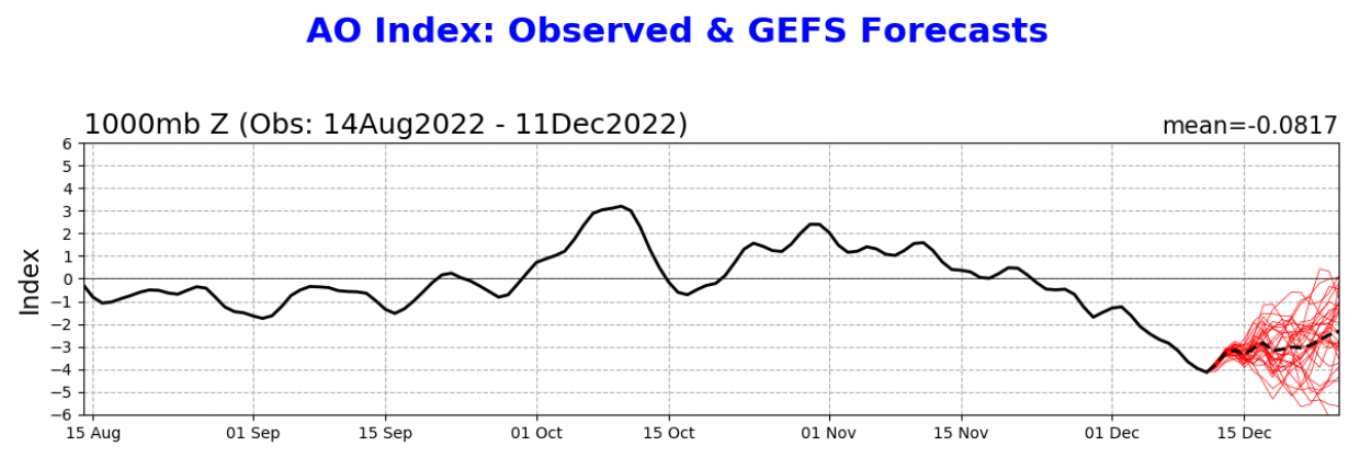
This link to a National Weather Service webpage has some interesting graphics to help explain how the Arctic Oscillation (AO) can affect our temperatures here and what causes that change. The short version is "the negative phase allows cold air to plunge into the Midwestern/Eastern United States;" we are firmly in the negative phase and likely to stay there for the next several days.
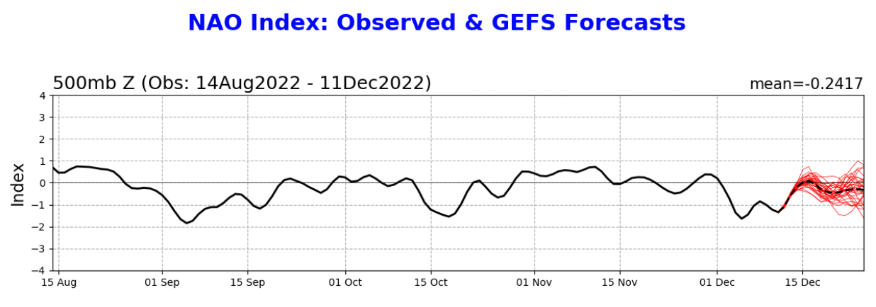
Above you see the NAO (North Atlantic Oscillation) has also been recently negative and is likely to stay negative or approach neutral. A negative NAO leads to below normal heights and pressure across the eastern U.S., which translates to colder air. On it's own one of these factors won't usually be enough to completely flip our weather pattern, but when the come together to reinforce the ability for cold air to reach us, like what is happening this week, we can see a big temperature drop.


