
It's not secret that April has been a very dry month for our area, when typically it's one of the wetter months of the year. We've been in a warmer-than-normal pattern that has kept a lot of the month above normal. That pattern is about to shift as we get into the latter half of this week and into this weekend.
Conditions are fairly calm as we get through Thursday. Temperatures will be on the steady rise through then and eventually topping out in the low 80s. However, our dry stretch is more than likely going to come to an end at some point late on Friday.
The Great Balloon Glow
There are two great balloon glows this year. There is one on Thursday and one on Friday. The better of the two for now weather-wise looks to be Thursday's because we are dry and warm.
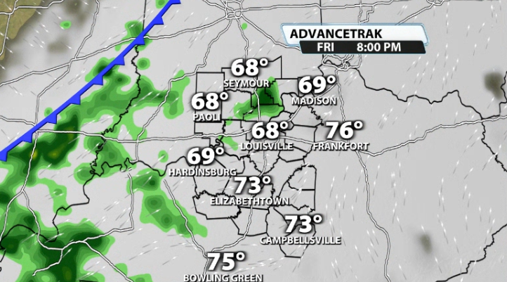
Friday's will be a little tough. It's not set in stone, but approaching showers and storms on Friday night could impact part of the glow. The timing isn't set considering its still far away, but data shows showers and storms arriving at some point late on Friday. Timing will be important for the Friday glow considering it isn't until 9PM.
Mini/Marathon
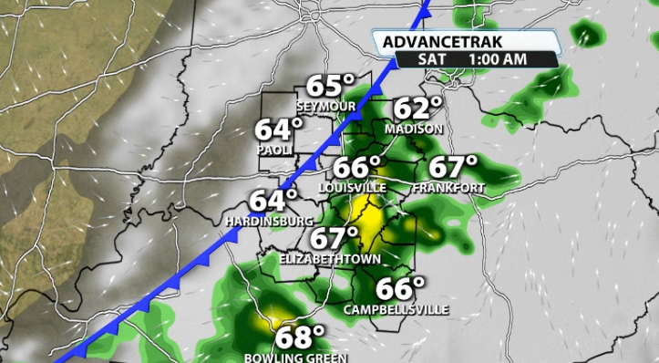
The Mini and Marathon are set for Saturday morning. Depending on when those Friday night storms go through, there could still be lingering rain/storms for the morning time that could affect the races. Again, it's still too far out for hyper-specific details, but that is currently where the data stands.
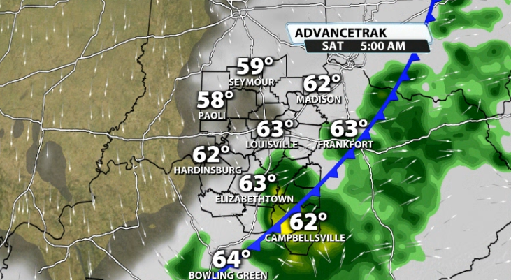
No need to alter plans yet, but know that rain and storms are a potential heading into Friday night and part of Saturday.
Long Term
Obviously the next question will be about Derby week. Here's what I can tell you; data (most models) are pretty hard set on a pattern shift toward cooler than normal temperatures heading into next week and next weekend. You can see the Climate Prediction Center's 8-14 Day Outlook backs this up by showing some of the blue shading in our area. That is valid for the dates of 4/28 - 5/4, which does include Derby.
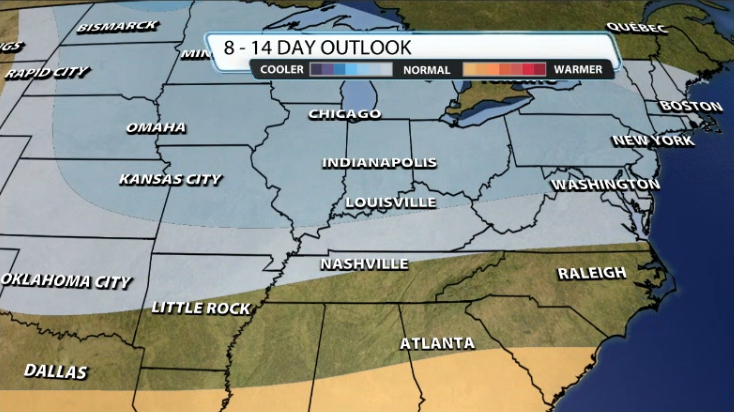
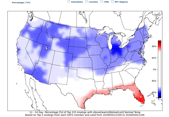
We can see this popping up in analog data as well. CIPS extended analogs show around a 71% chance for Louisville to see below-normal temperatures in the 5/1 - 5/4 date range.

Figuring out rainfall in this timeframe is more difficult. With us getting into what we call "closed Low" season, it can provide greater chances for rain where low pressures go. The "closed lows" we often see around derby time move slowly and can provide longer rainy & cloudier conditions. These lows are detached from the jet stream, so they move much slower.
The CPC currently has us right in the middle and "near normal" for rainfall during that timeframe:

So, rain chances aren't known yet for derby weekend as it's just simply too far away, but most data does agree on cooler than normal temperatures. For reference, our "average" or "normal" high temperature for derby day this year is 74.


