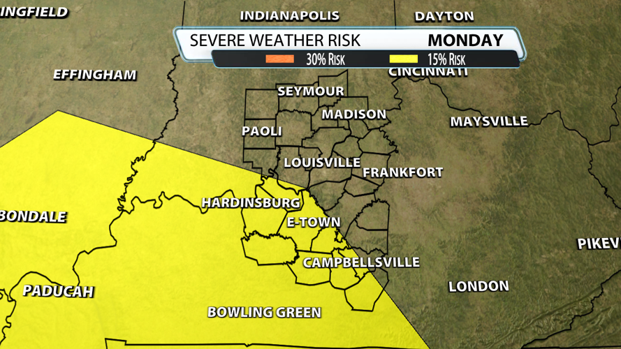

Thunder is now in the rear-view mirror and Derby Week is fast approaching. A pattern change will also mean more storm potential. Louisville is down -6.32 of rain since January 1st which means we need it. Unfortunately, that may also come with severe weather and Monday is now under a 15% risk just southwest of Louisville.

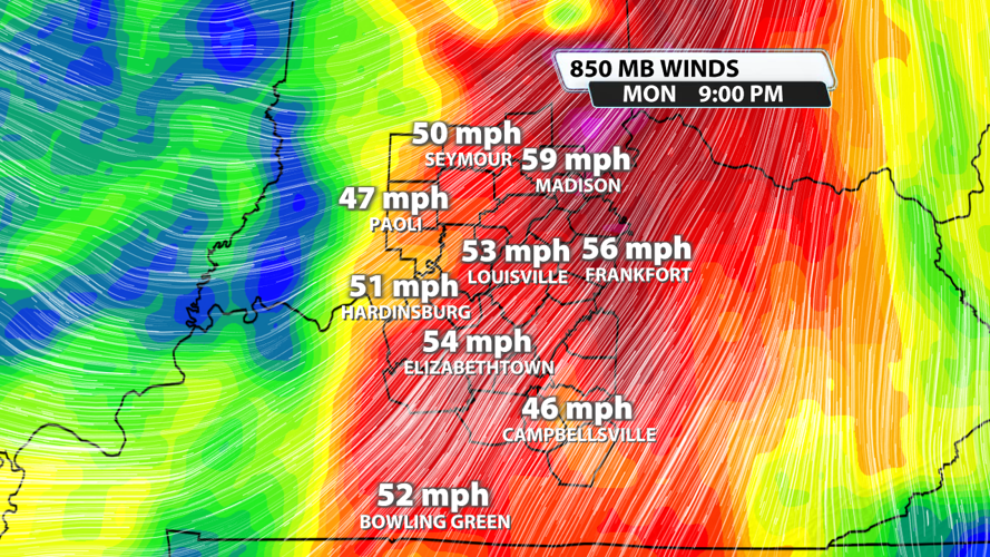
As of Tuesday evening, the data shows winds 1 mile above the ground at 55 mph. That meets the criteria we use of 40 mph for organized severe weather. Remember, we are looking over 6 days out and this is only one of the severe weather ingredients.

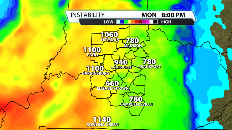
When it comes to fuel, if storms arrive late in the day they have about 1,000 units of instability. In general, CAPE values of less than 1000J/kg represent weak instability, 1000 to 2500J/kg moderate instability, 2500-4000J/kg strong instability, and greater than 4000J/kg extreme instability.

What do I think? At this range, there are so many moving parts that things could and likely will change. Damaging winds are the primary threat Monday the way it looks right now. It's also worth noting we aren't seeing signals for a major event or severe weather outbreak in our area. We will stay in touch.


